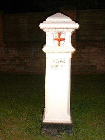
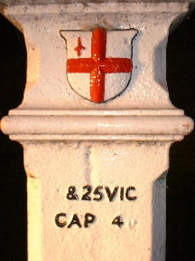
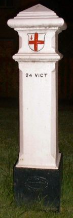
Coal and Wine Tax posts - All
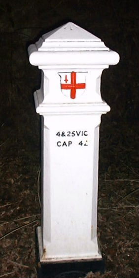
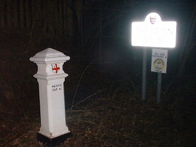
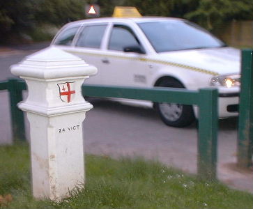
At the point where Debden Lane, Loughton becomes Loughton Lane, Theydon Bois.
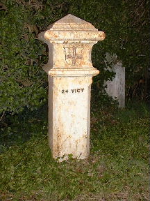
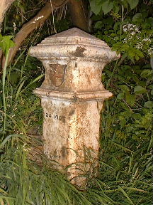
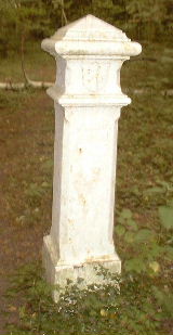
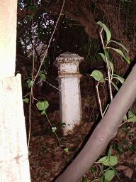
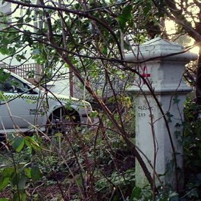
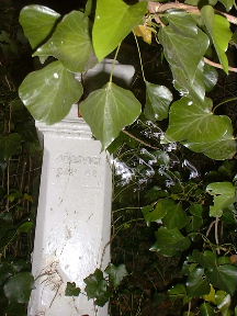
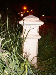
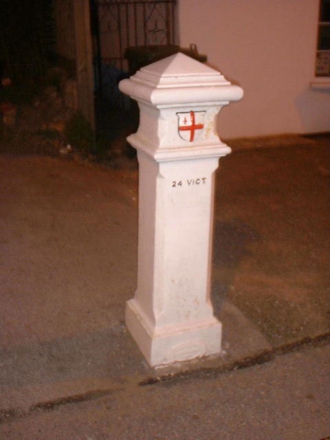
Opposite an house called "The Boundary".
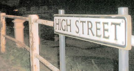
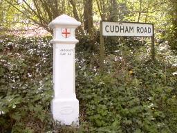
The retro-reflective sign in the right hand picture says Theydon Bois
South side of Coppice Row, Epping
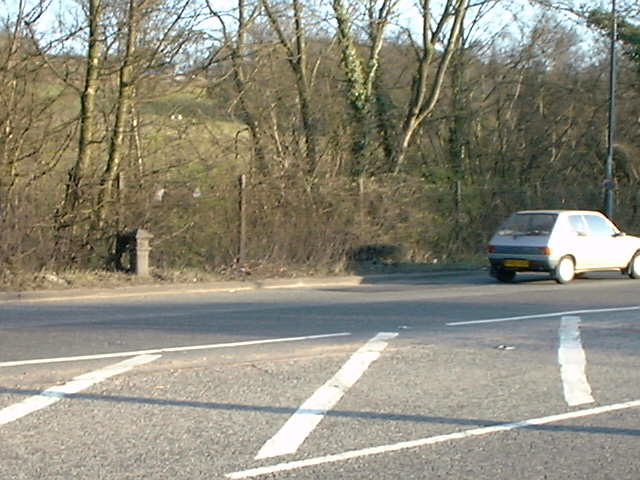
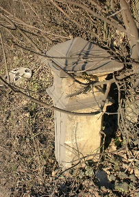
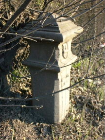
N of Jacks Hill, 500 yards E of the "Wake Arms"
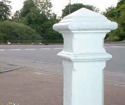
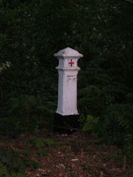
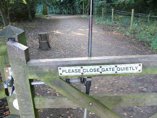
Bench mark on the top
Epping Road, Epping
about 500 metres SW of the Bell Common Tunnel
Wormley. Beside the Lea Navigation near King's Weir Bridge. Bench Mark.
In the first picture the Navigation is between the stone and the pole visible in the background.
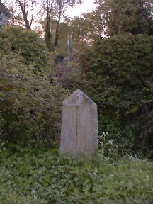
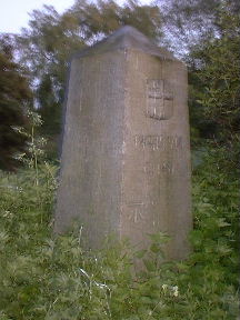
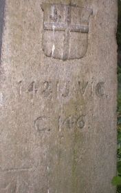
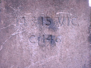
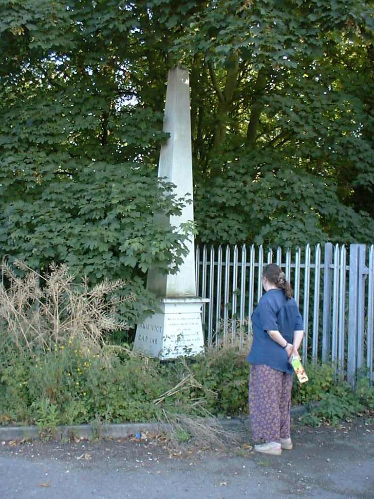
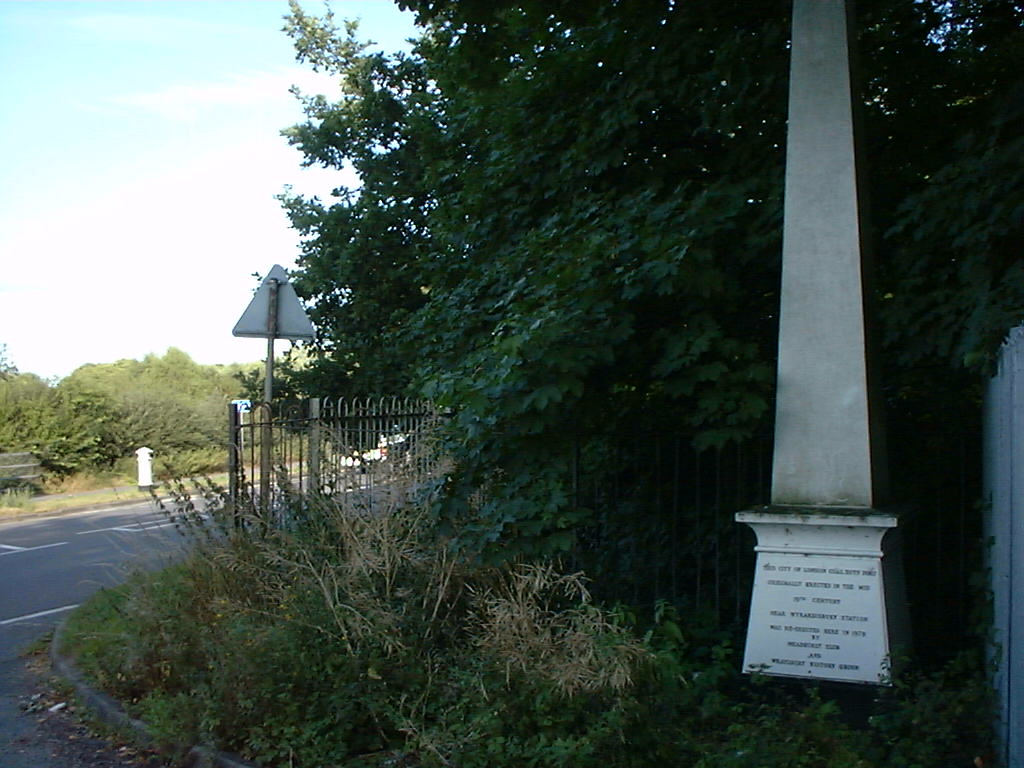
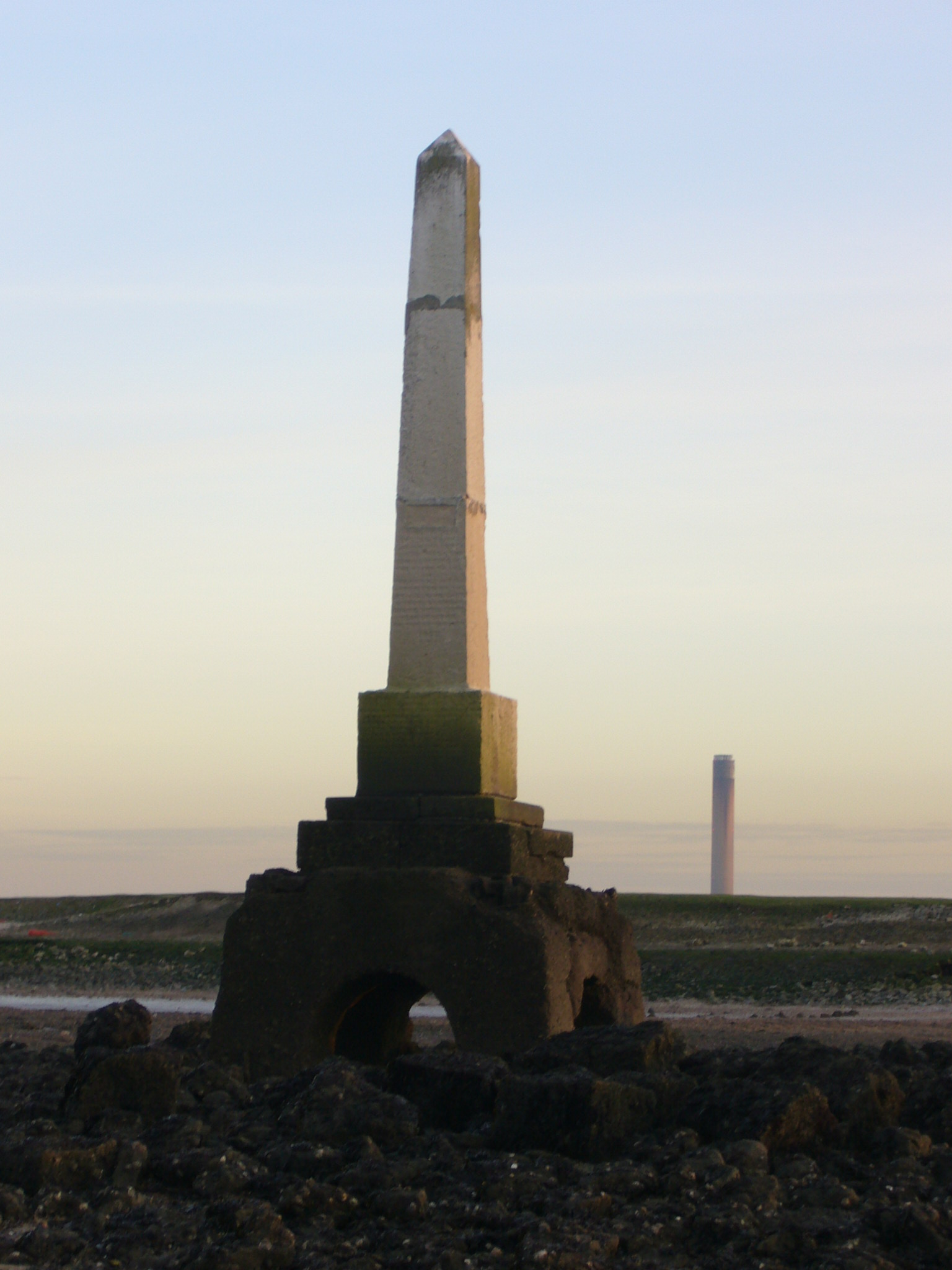
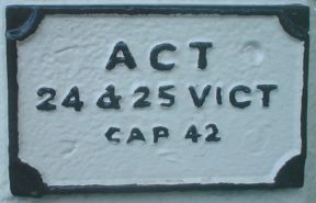
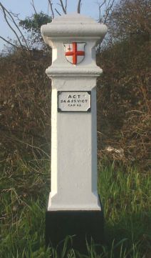
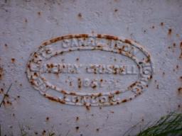
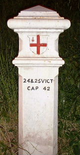
| Obelisk 21, TL 370 051 Slipe Lane, Wormley. On east side of the railway line. Described in ?1966 as "lying in several pieces on the ground. The inscription not identifiable." Now re-erected, top foot or so of height missing but crest, inscription (14 & 15 VIC. C 146) and Bench Mark all clearly visible. (The photos of this obelisk and the canal stone above were taken at dawn on May Day morning while the light was a bit too weak for my camera.) |

|
| At the Brookmans Park site: | ||
| Posts 20 - 24
Post 25 not a Tax Post Posts 26 & 27 Posts 28 - 30 Obelisk 31 Posts 33 - 36 |
Wormley Newgate Street Essendon Northaw Potters Bar Hawkshead Colney Heath | |
High Street, London Colney
Just north west of the bridge over the River Colne
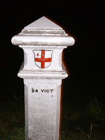
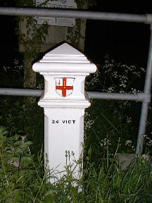
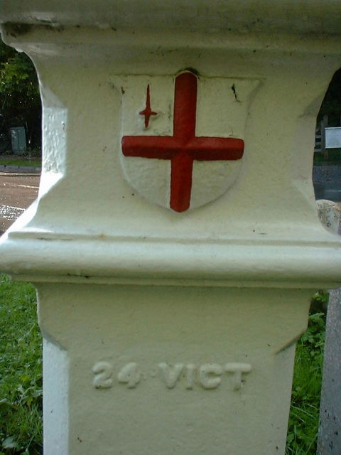
The entry at Historic England has a photo dated 2001 which shows distinct evidence of a plate over the “24 Vict” having been removed.
Shenley Lane, London Colney
South side of Broad Colney Bridge
Harper Lane, Shenley
Outside No. 108 The Lodge and near Harperbury Hospital
Harper Lane, Shenley
Outside No. 67
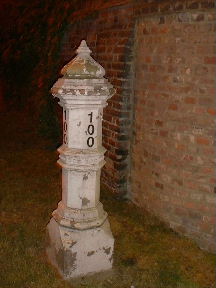
Midway between these two Tax Posts. Just a post to announce that this is No. 100 but nice echoes of Tax Posts.
Cab drivers on night shift wish that all houses showed their numbers as clearly as this.
Watling Street, Radlett
East side of road, opposite Kitswell Way, south of the culvert for a stream and half a mile north of the station
Watling Street, Radlett
West side of road, 100 yards north of Park Road, beside Radlett United Synagogue
|
Posts 47 & 48, TQ 110 964 Watford At either end of an alley between
The other post can be seen in the background of each of these pictures. No descriptive signs of any sort. No indication that these posts are not in their original positions - compare with the careful notice on Post 98 that it has been moved just two metres. | 
|
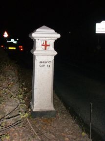
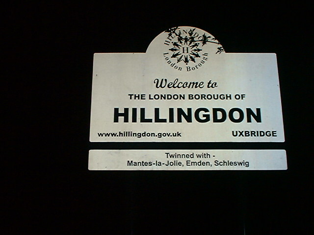
Rickmansworth Road, Harefield at the point where it becomes Harefield Road, Rickmansworth.
Just on to the Hertfordshire side of the county boundary - a 'Welcome to Hillingdon' sign can be seen on the right of this photo.
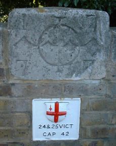
More pictures of this post in daylight and showing before- and after-restoration states
| Post 77, TQ 028 770 N side of Park Street, E of Colnbrook Bridge Plate 78 can be seen on the left of this picture See here how a slight change of viewpoint made all the difference between a "supplemental" grade for my photo and a geograph point for someone else. | 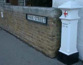
| ||
| Plate 78, TQ 028 770 in N parapet of Colnbrook Bridge | ||||
| Post 79, TQ 025 764 in field to SW of Poyle Manor on E bank of the Colne Brook. A difficult to reach location. Not yet visited. | Post 80, TQ 025 758 S side of Stanwell Road / Horton Road as realigned following the construction of the Wraysbury Reservoir, 300 yards E of junction with Coppermill Road. There is confusion on maps which suggest that Stanwell Road continues to the Poyle Road roundabout. This road sign suggests that the road changes its name on the boundary between Windsor & Maidenhead and Slough. This is the point where the post should be but unfortunately it seems to be missing. Certainly there is no undergrowth for it to hide in. | 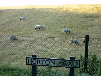
|
N side of Wraysbury Road, Staines and E side of the County Ditch about 40 yards E of Lammas Drive
As the name County Ditch suggests this is the boundary and we might expect there to have been a Post here originally. On the Victorian maps site we have a choice of three versions: Berkshire, Middlesex and Surrey. But none of them shows a post.
This may be the post that was originally at TQ 022 749, in field fence E of Moor Farm, Horton - now under the water of the Wraysbury Wreservoir.
S side of Wraysbury Road, Staines and W side of the County Ditch about 30 yards E of Lammas Drive
In the picture below left Post 81? can be seen in the background on the left.
Original location was
TQ 018 738
(not shown on the map but presumably near
the point where the County Ditch crosses the railway)
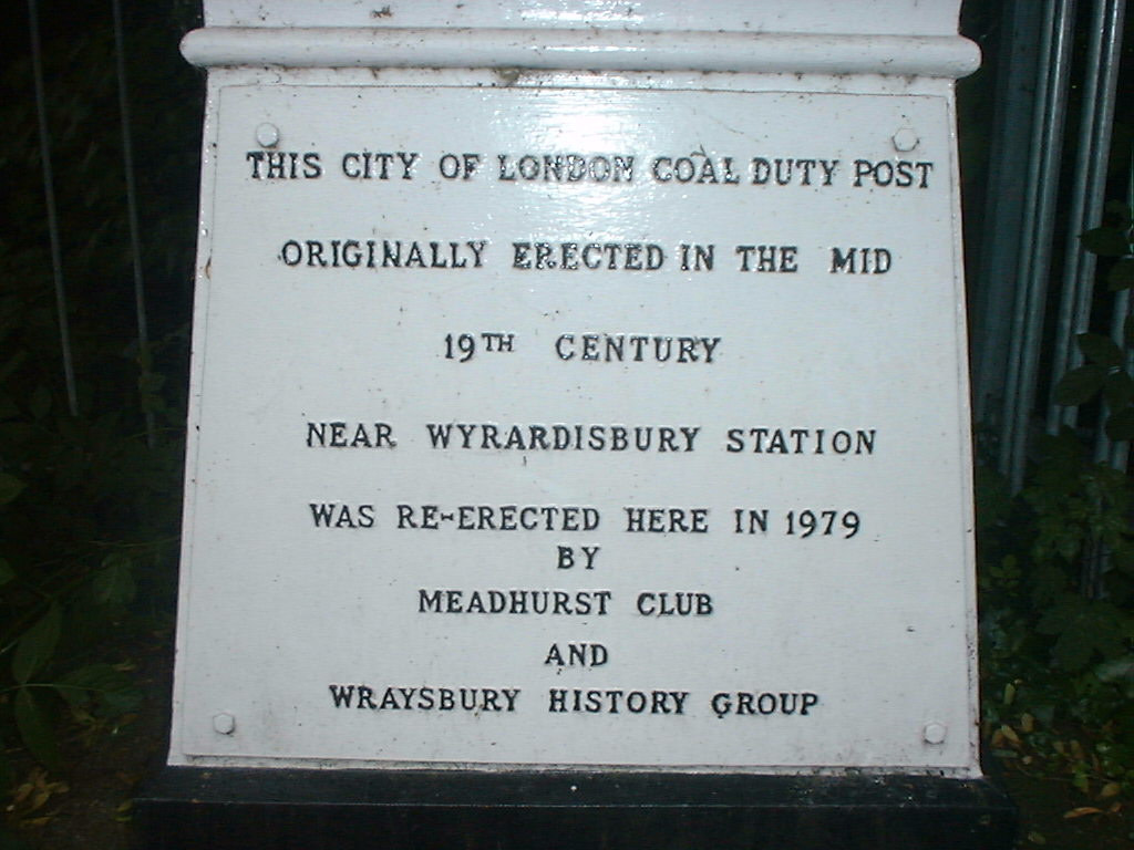
N side railway,
E of stream and 600 yards SE of Wraysbury Station
| 
| 
|
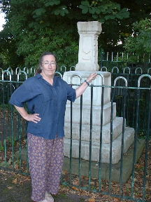


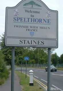
In Lammas Pleasure Ground, Staines beside the river.
The London Stone - the great … great grandparent of the posts
This is a replica (see below).
A board near the stone tells us:
Until 1350, management of rivers was in the hands of the monarch but in 1197 Richard I sold the rights and revenues of the lower Thames to the Corporation of the City of London. He did this to pay off debts incurred while fighting the Third Crusade.
At this time, Staines was the first town upstream from London with a bridge and stood at the tidal limit of the river so it was an obvious place to mark the Corporation's control. The stone stood beside the river near the old town bridge from 1285 until moved here two or three hundred years ago.
More recently the stone was removed for restoration and protection to the Old Town Hall Art Centre, Market Square, Staines and a replica put in its place.
The current Town
Bridge, Staines was erected after the stone had been moved to the
Lammas.
One face of the stone (facing right in the picture above) displays semi-
circular indentations. These were made by the tow ropes of horse-drawn
vessels rubbing against the stone. The same damage can be seen on
almost every bridge over every British canal (see below).
There is also a London Stone in Cannon Street. But that one is even older and quite different.
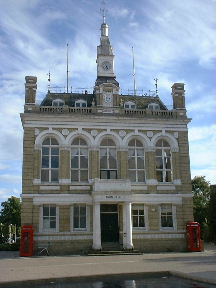
The Old Town Hall, Market Square, Staines
Shepherds Bridge, midway between Dreweat's Bridge and Kintbury Bridge
(Kennet and Avon Canal)
|
Downstream digression, TQ 860 786 Beside the mouth of Yantlet Creek, Isle of Grain Another London Stone.
This marked the downstream limit of the Corporation's control.
Note that while the London Stone, Staines (above) lies right on the line of route of
the Coal and Wine Tax Posts, this London Stone by Yantlet Creek lies about 20
miles further downstream from the line of route which crosses the Thames
at the mouth of the Darent. (Note how long this article went before anybody else edited it! And I certainly had not left it an orphan.) More of my pictures My image on geograph Page on John Eade's Thames website |
Bridge Street, Walton on Thames
Approach to Walton Bridge
| 
| 
| ||
| Obelisk 102, TQ 140 658 North side of railway beside No 100 Douglas Road, Esher Opposite junction with Blair Avenue | Post 103, TQ 139 657 South side of Lower Green Road, Esher Opposite Lower Green Open Space and railway bridge leading to Douglas Road | Post 104, TQ 145 653 North side of Portsmouth Road, Esher 600 yards west of the Scilly Isles, almost built into "The Toll House" |
Copsem Lane, Oxshott
Corner of The Rythe private road, south of Esher Common Roundabout
Copsem Lane, Oxshott
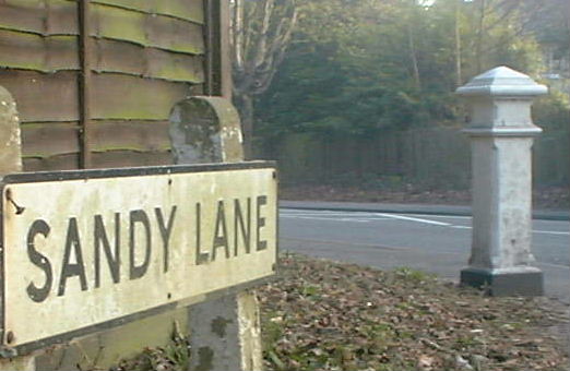
junction with Sandy Lane and Warren Lane
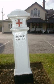
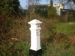
W side of Kingston Road, Leatherhead at the point where it becomes Leatherhead Road, Malden Rushett outside "The Star"
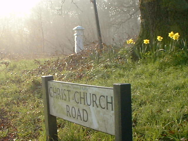
Christ Church Road (thus on maps but Christchurch Road on road name signs), Epsom. North side of road in Stew Pond Valley about 200 yards east of Post 119.
Half buried and becoming rusty.
|
|
|
|
|
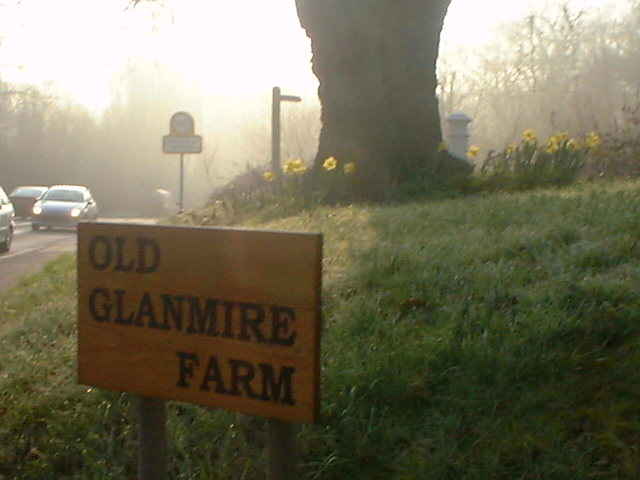
At the point where Christ Church Road, Epsom becomes Rushett Lane, Malden Rushett.
South side of road outside Glanmire Farm.
North side of Dorking Road,Epsom
at the point where it becomes Epsom Road, Ashtead
junction with Langley Vale Road and Downs Road
20 yards east of Walton Road (bridleway) on Epsom Downs
in clearing, 150 yards north of junction with Old London Road (bridleway)
In need of re-painting
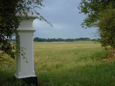
West side of Old London Road, Epsom Downs
by its southern crossing of Race Course.
The inscription faces into a thorn bush but it has still been carefully repainted.
From this post the next three posts on the list are all visible:
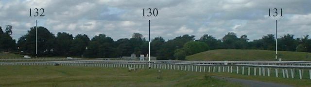

Post 131 can be seen in the background of the left photo.
The stumps of the bolts which held the correction plate in place have each
received a dab of black paint as though they were part of the inscription.
(Furlong and florin are two words which sadly are dropping out of the language. Both are still valid and both were part of attempts to decimalise the Imperial system of measures. 1 furlong = 10 chains = 1000 links. Also, the furlong is conveniently close to 200 metres - 201.168 metres to be precise.)
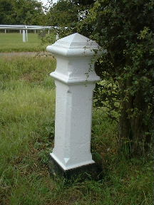
| Post 131, TQ 224 581 E side of Epsom Lane North, Tattenham Corner, 100 yards S of Tattenham Crescent, on a grassy knoll. The grandstands of Epsom Racecourse can be seen in the background of this picture. The post may have been moved a few yards further from the road when this area was tidied in 1994 after a train driver fell asleep and damaged the old station. | 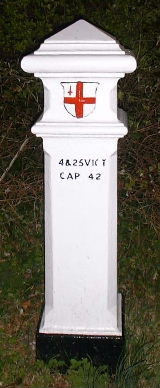
| Post 132, TQ 225 584 Outside the Tattenham Corner Public House |
Epsom Lane North, Tadworth
outside No. 100
| Post 135, TQ 226 560
South side of Motts Hill Lane, Tadworth. 100 yards west of The Avenue behind a fence | 
| Post 136, TQ 226 558
West side of footpath at a branch in the path, 150 yards south of Motts Hill Lane, Tadworth. The path continues south past The Bell public house to Withybed Corner. |
| Post 137, TQ 227 553
West side of Deans Lane, Walton on the Hill. Near the junction with The Street and beside the entrance to Deans Close. This view is looking northwest from the post and shows the Mere Pond with swans on it. | 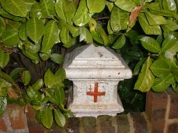
| Post 138, TQ 228 552
West side of Deans Lane, Walton on the Hill in garden of "The Rise". The occupiers of this house, showing a proper respect for the City's crest, have put a dip in the wall to enable it to be seen. (Compare with the way Post 136, above is totally ignored.) |
| Post 139,
TQ 229 551
East end of Chucks Lane, Walton on the Hill, on edge of Banstead Heath | 
| Post 140, TQ 230 548
Southeast side of Dorking Road, Walton on the Hill, 400 yards northeast of the junction with Deans Lane |
| Post 141, TQ 231 547
100 yards southeast of Post 140 on Walton Heath | 
| Post 142, TQ 232 546
150 yards southeast of Post 141 on Walton Heath. Nail says "beside sheds". Sheds have gone. This view is looking southwest across the golf course |
The view from near Post 152
East side of Brighton Road, Kingswood
100 yards south of Birch Grove
Outwood Lane, Chipstead
Opposite Stagbury House
Hazelwood Lane, Chipstead
At the junction with Bridgeway and Stagbury Close
W side of How Lane, Chipstead
opposite Yew Tree Close
Almost buried in the undergrowth.
The squiggles in the photo are spots of daylight plus camera shake.
At the junction of Coulsdon Lane, Hollymeoak Road, Portnalls Road, Rickman Hill Road and Hollymead Road, Chipstead


Try this image as a jigsaw
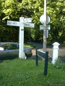
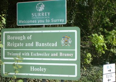
Brighton Road, Hooley
East side of road about 150 yards north of the present boundary between Croydon and Reigate & Banstead.
Very dirty because this is a very busy road and very difficult to spot when the trees are in leaf.
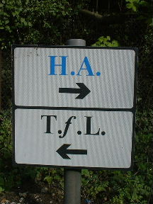
The middle one is almost as cryptic as a Tax Post: HA = Highways Agency TfL = Transport for London
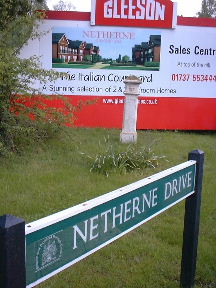
Brighton Road, Hooley
Corner of Netherne Drive, beside Star Bridge.
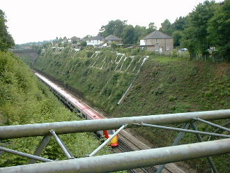
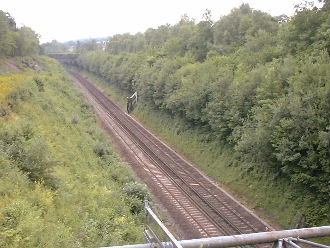
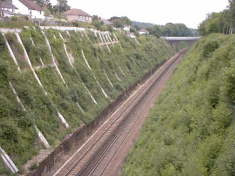
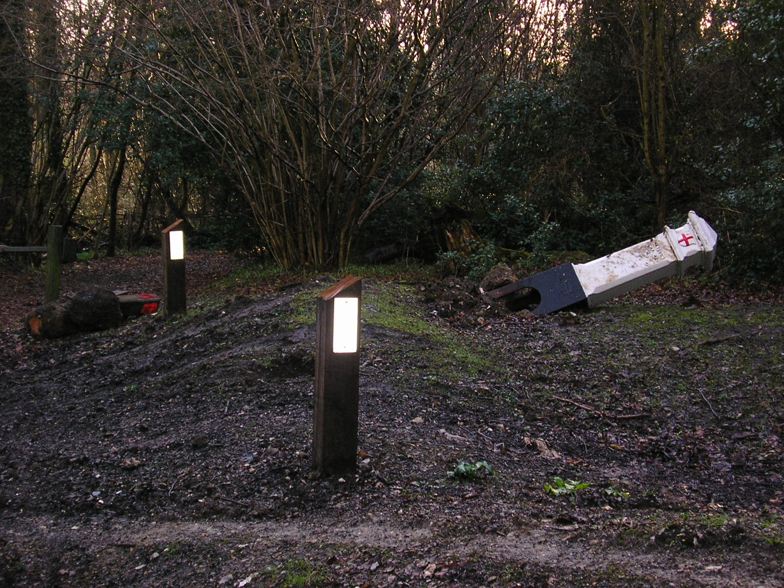
| Not found! Obelisk 165, TQ 289 567 | ||
| The western of two ... | The eastern of two ... | ... cuttings at this point |
| 
| Looking south from Star Bridge (Netherne Drive) |
| 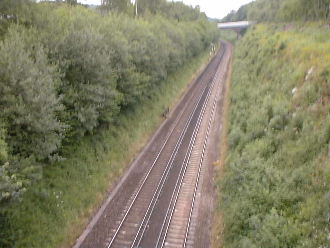
| Looking north from Forge Bridge |
|
'West side of Redhill railway line at Hooley, 100 yards south of Star Bridge' [CoL] The Corporation of London page singles out this Obelisk for mention as 'inaccessible except by rail'. But in fact you get a clear view of this part of the track from Star Bridge or Forge Bridge, 300 yards further south. I would expect to see the Obelisk in both the left hand pictures above but I have looked very carefully and cannot see any sign of it. | ||
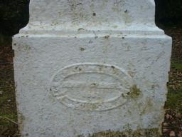
Ditches Lane, Coulsdon
near Devilsden Wood
This post is a bit accident prone.
Images produced from the www.old-maps.co.uk service with permission of Landmark Information Group Ltd. and Ordnance Survey where www.old-maps.co.uk is hyperlinked to http://www.old-maps.co.uk, Landmark Information Group Ltd. is hyperlinked to http://www.landmark-information.co.uk and Ordnance Survey is hyperlinked to http://www.ordnancesurvey.co.uk
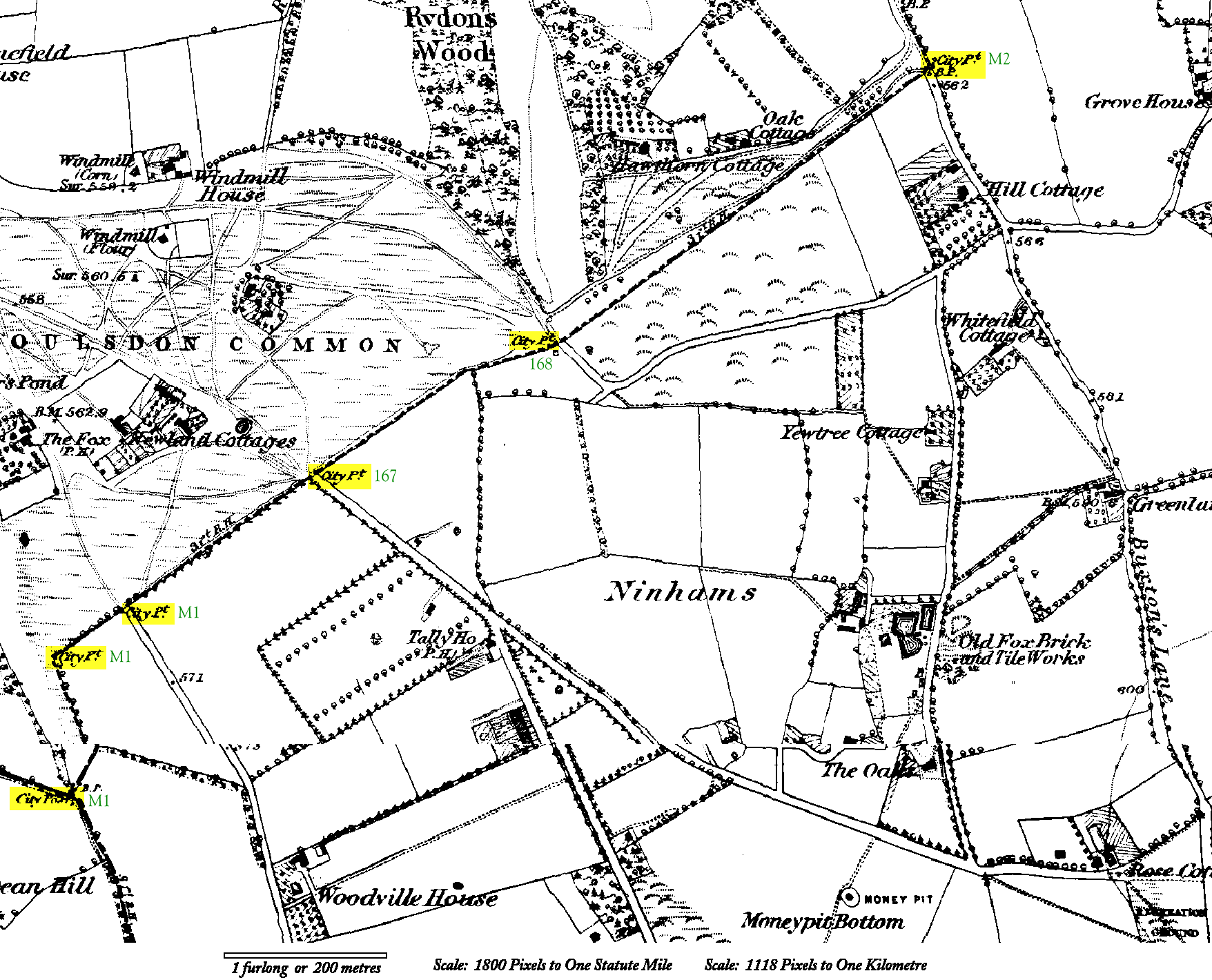
TQ 318 563
TQ 318 565
TQ 320 566
One post just off the end of The Grove, Coulsdon Common and two posts in The Grove.
Marked M1 on the map.
Click on the map for a larger version.
Note The Fox and the Tally Ho pubs; both still there.
On the larger version, near bottom right note the intriguing Money Pit still remembered in the name of Money Road.
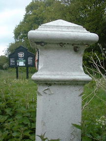
Coulsdon Road, Coulsdon Common opposite The Grove.
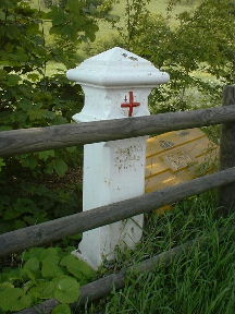
On the present boundary between Croydon and Tandridge

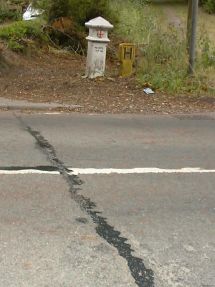
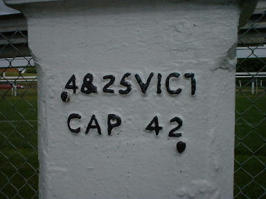
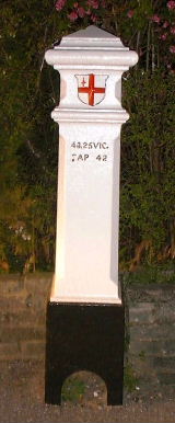
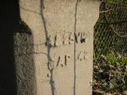
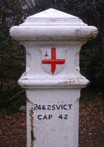
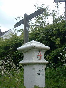
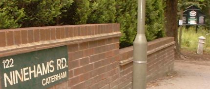
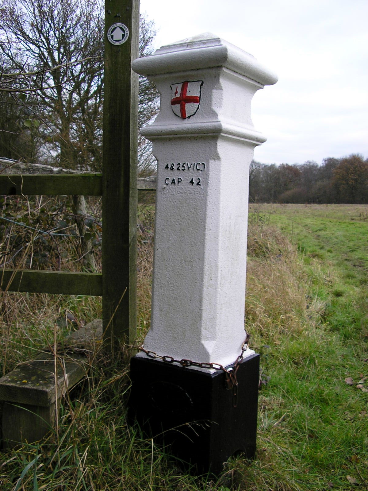
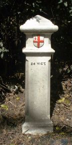
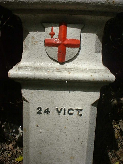
Coulsdon / Caterham, on SW side of road 90 yards NW of the junction of Ninehams Road and Milton Road. (Carefully worded -see below.)
On the present boundary between Croydon and Tandridge. (Note the join in the road surface between the two authorities.)
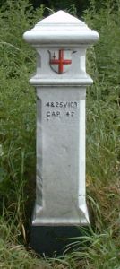
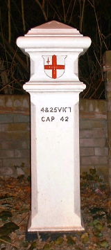
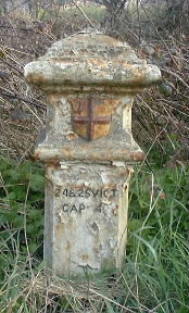
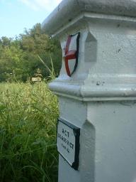
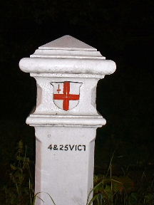
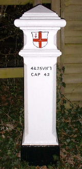
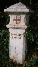
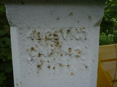
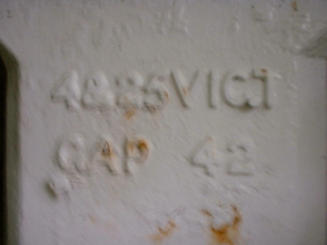
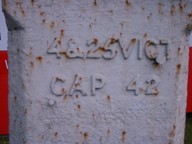
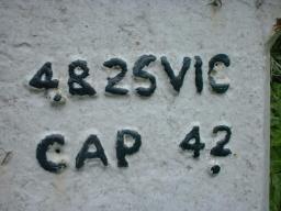
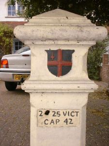
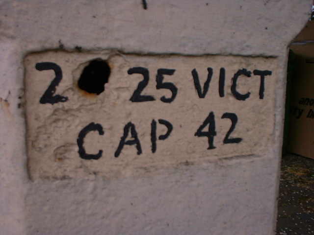
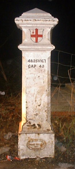
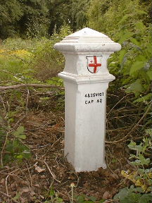
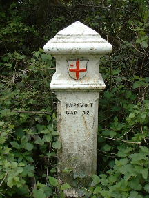
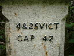
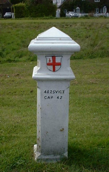
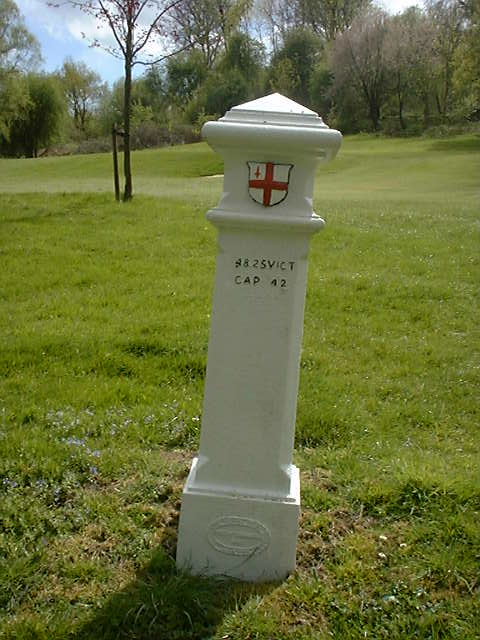
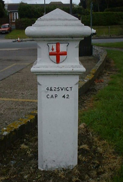
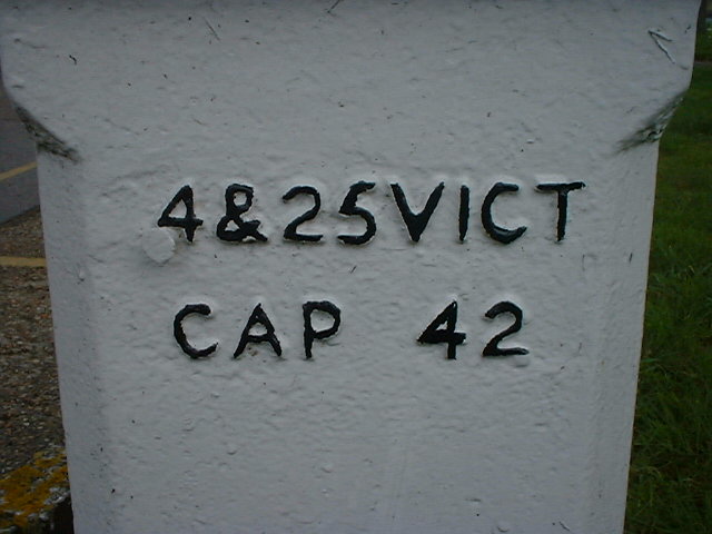
Also the 2 of CAP 42 is so flat that it has been painted wrongly.
|
All the old lists seen describe the house nearest to this post as
22 Stites Hill Road and all road maps seen show Stites Hill
Road extending to the Junction with Milton Road. However the
Postcode directory is perfectly clear that the six houses along this
90 yard stretch of road are 112 to 122, Ninehams Road, CATERHAM,
CR3 5LJ. Neither of the local authorities has erected road name signs to indicate that maps are wrong. It has been left to the owner of the house nearest the post to clarify the situation. The post was erected to mark a boundary and it still does mark a boundary. This site notes several places where a road changes its name on the boundary and it is the case here as well. |
|
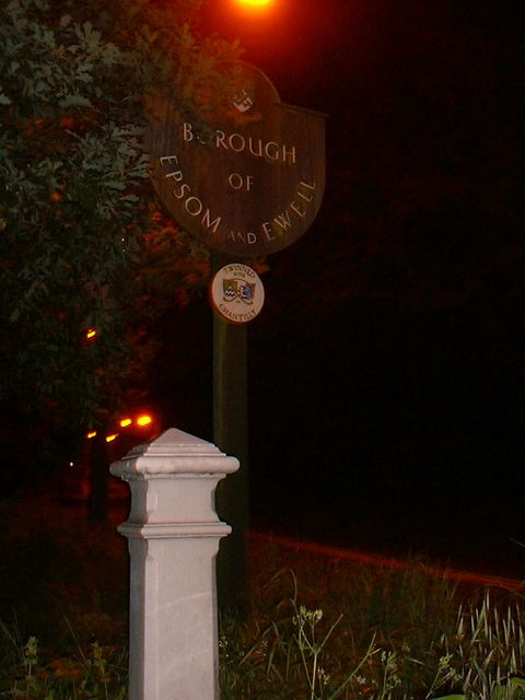
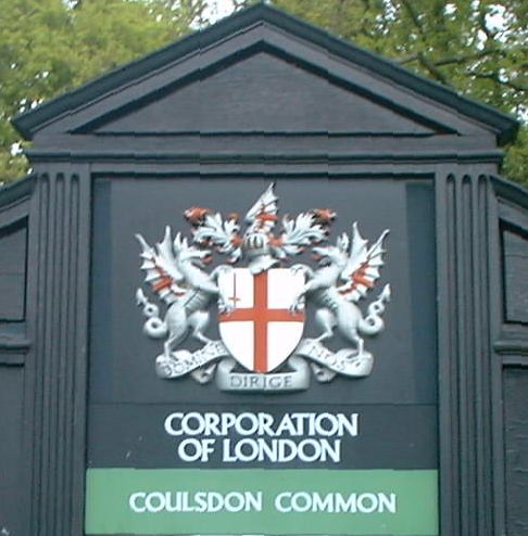
CORPORATION OF LONDON COULSDON COMMONS The Corporation of London is the local authority for the City of London.
It provides services not only in the City but also far outside its boundary. |
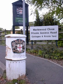
Corner of Ninehams Road and Merlewood Close, Caterham
Outside the Corporation of London's Estate Office for the commons mentioned above.
This is not a Tax Post and is quite recent. But it carries on the cast iron Corporation of London tradition. It is just a post to keep your vehicle off the kerb or grass - and of an height designed to ensure that you will not see it just before you reverse into it.
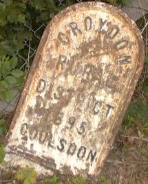
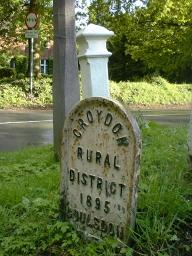
East side of Buxton Lane, Caterham at the point where it becomes Hayes Lane, Kenley.
Marked M2 on the map above and on the larger version.
This post is leaning and bears the inscription 'Croydon Rural District 1895 Coulsdon'.
An identical post to this one stands beside City Post 162 in Chipstead and as we can see on the map there ought to be a City Post standing here but it has long since vanished.
The name Buxton Lane had struck me as odd because it is clearly an old road from long before the habit of naming roads after holiday destinations. The larger map gives us an answer by calling it Buxton's Lane - it is named after a person. But a developer has picked up on the geographic idea and built Matlock Road off it.
Whyteleafe Hill, Whyteleafe
50 yards east of the junction with Hornchurch Hill

This view from Church Road is about the best you can legally get.
More images

Behind No 376 Godstone Road, Whyteleafe
Sit on the right hand side of the train from Caterham to East Croydon and hope that it will not go too fast between Whyteleafe South and Whyteleafe.
Or find the allotments in Church Road, 300 yards S of Whyteleafe Hill, walk through them towards the railway and look to your right.
W side of Godstone Road, Whyteleafe
300 yards north of Salmons Lane, outside No. 376
The original inscription has been carved out to a depth of about 5 mm. As a result of this and/or subsequent rust, there is a hole right through to the inside.
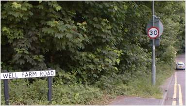
Well Farm Road, Whytelefe
100 yards from Godstone Road
At both of these locations there may be a post hiding among all that lush vegetation but I have looked very hard and could not see either of them
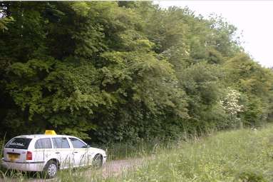
Stuart Road, Whytelefe
100 yards from Woldingham Road
Viewed from Post 174
Woldingham Road, Whytelefe
junction of Stuart Road
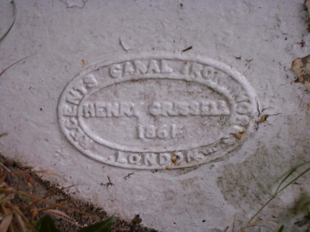
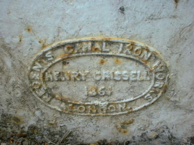
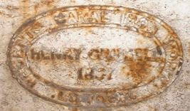
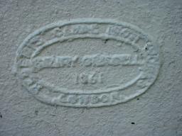
Makers mark on front and rear of the base

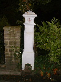
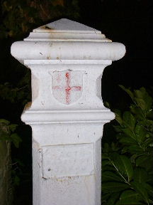
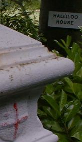
Bug Hill, Woldingham outside "Halliloo House"
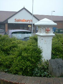
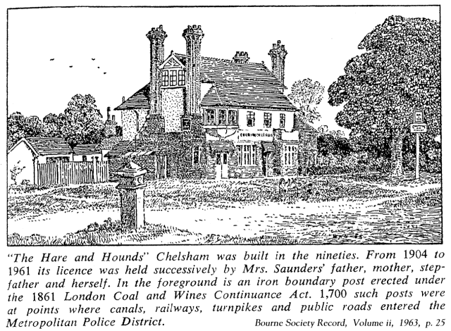
Limpsfield Road, Warlingham outside Sainsbury's supermarket.
A plaque in front of the post has been removed by vandals
but thanks to Alan C Edwards we can deduce what it said:
In 1994 the site of Chelsham Bus Garage was being re-developed as a
Sainsbury's supermarket.
On 1994 January 24, Monday this post was removed from its original position
at the SW corner of the junction of Limpsfield Road and Chelsham Road to
make room for a roundabout large enough allow articulated lorries to enter
Sainsbury's delivery bay.
On 1994 July 27, Wednesday the post was re-erected at the corner of the new
pedestrian walkway between the bus layby and the entrance to the
supermarket.
IRON BOUNDARY POSTS
The item in Bulletin No. 6 on this subject produced a good deal of information from a number of members. One or two queries are now being investigated and it is hoped to publish a supplement to the next issue of the Bulletin giving a complete list of the posts, or the sites of posts, which are situated within our area.
One thing that should be put right immediately is the statement made in the last issue as to the total number of posts erected around London. The figure quoted was l,700, which was taken in good faith from a newspaper cutting on the subject, but many members have written in to say that 200-250 is much nearer the mark, and their information is supported by contemporary evidence.
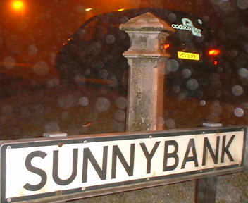
| Post 177, TQ 366 584 Sunny Bank, Warlingham junction of Chelsham Road The spots on this picture are, I believe, fog | 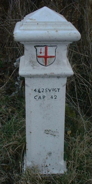
| Post 178, TQ 371 591 Harrow Road, Warlingham junction of Chelsham Road |
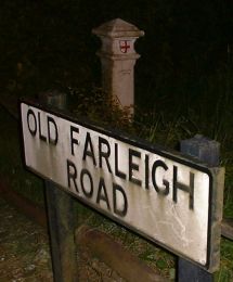
East side of Old Farleigh Road, Farleigh just north of "The Harrow"
North end of Daniels Lane, Farleigh at edge of Little Park Wood
On the edge of Little Farleigh Green on footpath to Fickleshole. About 200 yards NW of the point where Farleigh Court Road becomes Scotshall Lane.
Lorna van Zee's
image at GeoGraph. Note the discussion.
My image at GeoGraph.
Two more images.
A better picture of this post
Post 183, TQ 395 613
King Henry's Drive, New Addington
200 yards north west of the junction of Skid Hill Lane and Layhams Road, etc.
Post 184, TQ 396 610
Skid Hill Lane, New Addington
100 yards south of the junction of King Henry's Drive and Sheepbarn Lane, etc.
Sheepbarn Lane, New Addington
150 yards east of the junction of Skid Hill Lane and Layhams Road, etc.
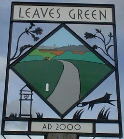
On Leaves Green
The village sign in the first picture can be seen in the background of the third picture.
This post before the paint job (see below).
Green Hill, Downe
Near one of the greens of West Kent Golf Club.
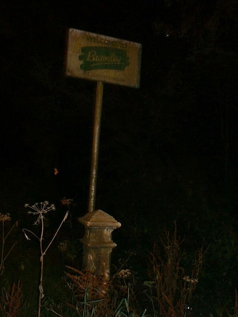
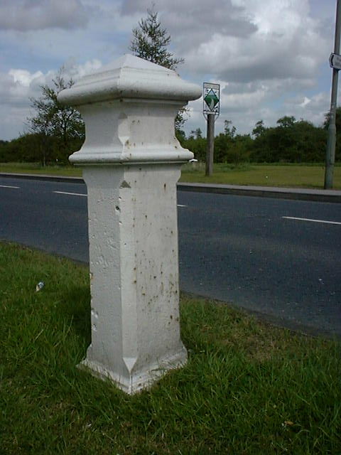
This post is leaning
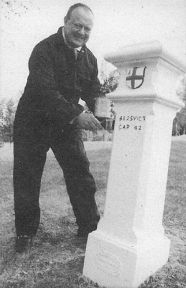
"Councillor George Taylor, holder of Bromley Council's Environment Portfolio, rolled up his sleeves to put the finishing touches to the club's freshly repainted Coal Tax Post"
from Rabbit, The Planning Division Newsletter of the London Borough of Bromley, November 2002
|
| 
| ||
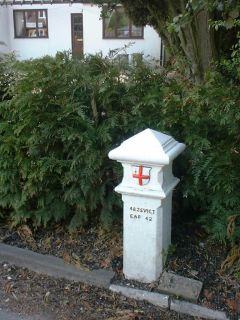
| Post 188, TQ 435 600 Single Street, Berry's Green near the point where it becomes Luxted Road. Outside a bungalow called Brambleside | Post 189, TQ 439 606 At the point where Cudham Road, Downe (also known as Hangrove Hill) becomes Downe Road, Cudham. Outside an house appropriately called The Boundary | Post 190, TQ 451 629 West side of Cudham Lane, Cudham. Opposite No 83 | ||
Corner of Cudham Lane North and Old Hill,
Green Street Green
The black and white picture is from Rabbit, The Planning Division Newsletter of the London Borough of Bromley, November 2002 and the rabbit must be called Flopsy because they have flopped the picture (and also omitted 'post' from the caption).
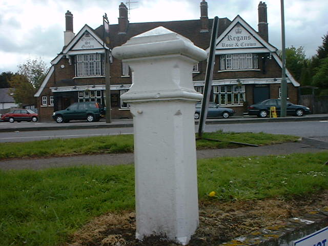
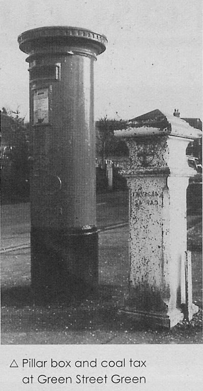
Near the roundabout, Green Street Green.
Between Farnborough Way and High Street. Near the Royal Oak and opposite the Rose and Crown
West side of High Street, Green Street Green.
Opposite Baptist Church
| Post 199, TQ 479 651 Chelsfield Lane, Chelsfield. Beside the entrance to Goddington Park | 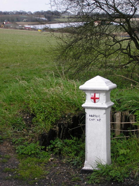
| Post 200, TQ 484 652 East side of Skibbs Lane. 1200 yards north of Chelsfield. That is not water in the background but plastic sheeting over crops. |
© 2003–2016 Roger W. Haworth


Main php file date: 2020 Jun 25 12:15:06 app file date: 2023 Sep 16 20:13:41