Coal Tax contents  |  Post List
 

Coal and Wine Tax posts  -  All posts gallery  -  (SQL)

Thumbnails. No border: thumbnail links to a 640 pixel image. Pink border: thumbnail links to bigger image. Blue border: left hand half of thumbnail links to bigger image; right hand half links to image description on the Wikimedia Commons.

back to start of section
Obelisk 60
Obelisk 69
0000-00-00 00:00:00 Fr:037175 Sq:069_175 0000-00-00 00:00:00 Fr:037175 Sq:069_175 0000-00-00 00:00:00 Fr:037175 Sq:069_175
0000-00-00 00:00:00 Fr:037176 Sq:069_176
0000-00-00 00:00:00 Fr:037177 Sq:069_177 0000-00-00 00:00:00 Fr:037177 Sq:069_177 0000-00-00 00:00:00 Fr:037177 Sq:069_177
0000-00-00 00:00:00 Fr:037178 Sq:069_178

Thorney
Post 72
2020-07-03 09:35:44 Fr:grip072 Sq:072.8
Post 73
2020-07-03 09:35:42 Fr:grip073 Sq:073.8

Longford
Posts 74 and 75
0000-00-00 00:00:00 Fr:038028 Sq:074.0
or Post 75
Posts 74 and 75 both probably lost forever during the building of the M25 which can be seen in the background of this image. The Wraysbury (or Wyrardisbury) River may well have been moved by a few yards.
Similarly Post 149 probably disappeared during the building of the M25. Compare with Posts 80 and 81 which appear to have been relocated during the building of the Wraysbury (or Wyrardisbury) Reservoir
0000-00-00 00:00:00 Fr:038029 Sq:074.1 0000-00-00 00:00:00 Fr:038029 Sq:074.1 0000-00-00 00:00:00 Fr:038029 Sq:074.1
Mad Bridge

Poyle
Post 76
The Nail list gives a description of TQ 037 770 on S bank of stream at NE corner of grounds of Poyle County Infants School.
It is probably the same school which is now called Pippins Primary School. A better grid ref for the post is probably TQ 0360 7692 and the post may be visible from Pippins Park accessed off Raymond Close
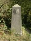
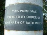
Poyle Pump
0000-00-00 00:00:00 Fr:038022 Sq:076.5.1 0000-00-00 00:00:00 Fr:038022 Sq:076.5.1 0000-00-00 00:00:00 Fr:038022 Sq:076.5.1
TQ 034 766 Poyle Pump S side of Bath Road about 10 yards E of junction with Dickens Place
2003-08-02 06:16:11 Fr:038020 Sq:076.5.5 2003-08-02 06:16:11 Fr:038020 Sq:076.5.5 2003-08-02 06:16:11 Fr:038020 Sq:076.5.5
2003-08-02 06:16:42 Fr:038021 Sq:076.5.6 2003-08-02 06:16:42 Fr:038021 Sq:076.5.6 2003-08-02 06:16:42 Fr:038021 Sq:076.5.6

Colnbrook
Plate 77
0000-00-00 00:00:00 Fr:038025 Sq:077.0 0000-00-00 00:00:00 Fr:038025 Sq:077.0 0000-00-00 00:00:00 Fr:038025 Sq:077.0
2003-08-02 06:58:07 Fr:038024 Sq:077.7
Opposite side of bridge
Post 78
0000-00-00 00:00:00 Fr:038026 Sq:078.0
0000-00-00 00:00:00 Fr:038027 Sq:078.2 0000-00-00 00:00:00 Fr:038027 Sq:078.2 0000-00-00 00:00:00 Fr:038027 Sq:078.2
with Plate 77 visible at far left
Post 80
2003-08-02 06:28:45 Fr:038023 Sq:080.0
Reservoir sheep

Staines
Post 81?
0000-00-00 00:00:00 Fr:037186 Sq:081_0
Wraysbury Road, Staines
0000-00-00 00:00:00 Fr:037030 Sq:081_030
Obelisk 82
0000-00-00 00:00:00 Fr:037184 Sq:082.184
0000-00-00 00:00:00 Fr:037185 Sq:082.185
0000-00-00 00:00:00 Fr:037187 Sq:082.187
0000-00-00 00:00:00 Fr:037029 Sq:082_029

London Stone
Stone 83
2003-07-04 18:23:08 Fr:037028 Sq:083_00 2003-07-04 18:23:08 Fr:037028 Sq:083_00 2003-07-04 18:23:08 Fr:037028 Sq:083_00
The London Stone - the great … great grandparent of the posts.
2003-07-20 18:39:40 Fr:037183 Sq:083_01
2003-07-04 18:17:31 Fr:037022 Sq:083_022
2003-07-04 18:17:50 Fr:037023 Sq:083_023
2003-07-04 18:18:15 Fr:037024 Sq:083_024
2003-07-04 18:18:52 Fr:037025 Sq:083_025
2003-07-04 18:19:36 Fr:037026 Sq:083_026
0000-00-00 00:00:00 Fr:037027 Sq:083_027 0000-00-00 00:00:00 Fr:037027 Sq:083_027 0000-00-00 00:00:00 Fr:037027 Sq:083_027
Bridge 73
0000-00-00 00:00:00 Fr:038261 Sq:083_71
Downstream digression
2007-01-31 16:25:47 Fr:tq8678_342 Sq:083_73

Staines
The Old Town Hall
2003-07-20 18:21:31 Fr:037179 Sq:083_a179
2003-07-20 18:22:17 Fr:037180 Sq:083_a180
2003-07-20 18:23:06 Fr:037181 Sq:083_a181
2003-07-20 18:24:23 Fr:037182 Sq:083_a182
Post 84
2005-06-21 09:45:07 Fr:056197 Sq:084.197
Post 85
2005-06-21 09:47:44 Fr:056198 Sq:085.198
2005-06-21 09:49:21 Fr:056199 Sq:085.199
2005-06-21 09:58:16 Fr:056200 Sq:085.200
2007-04-30 08:54:35 Fr:074305 Sq:085_305
2007-04-30 08:55:28 Fr:074306 Sq:085_306
2007-04-30 08:57:05 Fr:074307 Sq:085_307
2007-04-30 08:58:28 Fr:074308 Sq:085_308
Post 86
0000-00-00 00:00:00 Fr:074303 Sq:086_0
0000-00-00 00:00:00 Fr:074302 Sq:086_302
2007-04-30 08:53:23 Fr:074304 Sq:086_304
near Post 86
2007-04-30 08:47:30 Fr:074300 Sq:086_b300
2007-04-30 08:48:31 Fr:074301 Sq:086_b301
Obelisk 87
2006-03-14 09:38:02 Fr:063124 Sq:087_124
2006-03-14 09:38:58 Fr:063125 Sq:087_125
2006-03-14 09:40:05 Fr:063127 Sq:087_127

Walton on Thames
Post 94
2003-03-25 07:05:29 Fr:033247 Sq:094_0
0000-00-00 00:00:00 Fr:033245 Sq:094_245
2003-03-25 06:49:59 Fr:033246 Sq:094_246
Thames Conservancy post
2006-03-14 10:26:21 Fr:063133 Sq:094_a133 2006-03-14 10:26:21 Fr:063133 Sq:094_a133 2006-03-14 10:26:21 Fr:063133 Sq:094_a133
just upstream of Walton Bridge, near to Post 94
2006-03-14 10:27:11 Fr:063134 Sq:094_a134
2006-03-14 10:27:38 Fr:063135 Sq:094_a135
2010-07-28 04:27:58 Fr:post 2, front view Sq:094_a2093501
2010-07-28 04:32:02 Fr:post 2, rear view Sq:094_a2093502
2010-07-28 04:30:35 Fr:post 2, detail Sq:094_a2093504
The Wikipedia article about Thames Conservancy shows this post

Sunbury on Thames
Post 96
0000-00-00 00:00:00 Fr:044248 Sq:096.0
2004-04-26 06:45:13 Fr:044245 Sq:096.1
0000-00-00 00:00:00 Fr:044244 Sq:096.244
0000-00-00 00:00:00 Fr:044249 Sq:096.249
0000-00-00 00:00:00 Fr:044250 Sq:096.250
near Post 96
0000-00-00 00:00:00 Fr:044251 Sq:096.b251
2004-04-26 06:53:22 Fr:044252 Sq:096.b252

West Molesey
Post 98
0000-00-00 00:00:00 Fr:037209 Sq:098.209
2003-07-26 07:01:32 Fr:037207 Sq:098_207
2003-07-26 07:02:09 Fr:037208 Sq:098_208
Post 99
0000-00-00 00:00:00 Fr:037210 Sq:099_210
0000-00-00 00:00:00 Fr:037211 Sq:099_211
Post 100
0000-00-00 00:00:00 Fr:037212 Sq:100_212

Esher
Obelisk 102
0000-00-00 00:00:00 Fr:036178 Sq:102_178
Post 103
0000-00-00 00:00:00 Fr:036179 Sq:103_179
Post 104
0000-00-00 00:00:00 Fr:036180 Sq:104_180
Post 105
2005-01-31 09:48:07 Fr:051360 Sq:105_0
0000-00-00 00:00:00 Fr:051358 Sq:105_358
0000-00-00 00:00:00 Fr:051359 Sq:105_359
Post 106
0000-00-00 00:00:00 Fr:051363 Sq:106_0
0000-00-00 00:00:00 Fr:051361 Sq:106_361
Post 107
0000-00-00 00:00:00 Fr:051366 Sq:107_0
0000-00-00 00:00:00 Fr:051365 Sq:107_365
0000-00-00 00:00:00 Fr:051367 Sq:107_367
Post 108
0000-00-00 00:00:00 Fr:051369 Sq:108_
0000-00-00 00:00:00 Fr:051368 Sq:108_368
Post 109
2003-03-23 02:15:30 Fr:033212 Sq:109_212
Marked on map 109, TQ 141 622 Copsem Lane, Oxshott
Corner of The Rythe private road, south of Esher Common Roundabout
2003-03-25 06:48:31 Fr:033244 Sq:109_a244
TQ 1407 6220 Copsem Lane, Oxshott
Corner of The Rythe private road
2003-03-23 02:16:52 Fr:033213 Sq:109_c213

Navigation

back to start of section
previous  un-annotatednext
previouslike this next
redisplay with: 45 64 127 180 items
full screen     search     index
$_COOKIE['vpt_dims']=×,  $_COOKIE['pathome']=,  $_COOKIE['em2px']=11.9 - more / less space for descriptions

Coal Tax contents  |  Post List
 
php file date:  2023 Jun 23  19:26:00 Valid HTML5 logo! Valid CSS! Valid Links!