Coal Tax contents  |  Post List
 

Coal and Wine Tax posts  -  All posts gallery  -  (SQL)

Thumbnails. No border: thumbnail links to a 640 pixel image. Pink border: thumbnail links to bigger image. Blue border: left hand half of thumbnail links to bigger image; right hand half links to image description on the Wikimedia Commons.

back to start of section
Oxhey
2012-06-07 16:52:57 Fr:126085 Sq:051085
TQ 10608 91682

Northwood
Obelisk 52
2012-06-07 17:16:46 Fr:126087 Sq:052.087
TQ 091 920 maps
o/s NW i/s NW   o/s NE i/s NE
i/s SW o/s SW   i/s SE o/s SE
2012-06-07 17:10:52 Fr:126086 Sq:052086
I cannot now recall where exactly I took this photo but I am pretty sure it is just the opposite side of the path from Obelisk 52. The railway at this point is the Metropolitan Line between Northwood and Moor Park. I cannot see why London County Council Tramways should need this box - more than an hundred yards from the nearest tram tracks.

Northwood telephone exchange
2012-06-07 17:50:45 Fr:126t98 Sq:05235
maps

Rickmansworth
Post 53
2012-06-07 17:32:39 Fr:126090 Sq:053090
2012-06-07 17:34:35 Fr:126092 Sq:053092
2012-06-07 17:35:08 Fr:126093 Sq:053093
TQ 087 922
Post 54
2012-06-07 19:22:02 Fr:126097 Sq:054097
I walked about 200m either side of TQ 084 923 and saw nothing
Moor Park
2012-06-07 19:09:42 Fr:126096 Sq:054590
Gates to Moor Park Mansion at TQ 078 925
2012-06-07 19:02:08 Fr:126095 Sq:054592
2012-06-07 19:01:27 Fr:126094 Sq:054594
Moor Park Mansion itself, TQ 074 932
Post 55
2012-06-07 19:33:00 Fr:126004 Sq:055004
2012-06-07 19:34:23 Fr:126005 Sq:055005
The seam in the road surface indicates that this is still a boundary - between Hillingdon on the left and Three Rivers district of Hertfordshire. TQ 078 923
Post 56
2012-06-07 19:50:45 Fr:126006 Sq:056006
TQ 069 915 at the junction of White Hill and Jackets Lane. Nothing seen
Post 57
2012-06-07 19:59:00 Fr:126t99 Sq:057099
maps
Post 58
0000-00-00 00:00:00 Fr:034157 Sq:058.157
2012-06-07 20:04:45 Fr:126u00 Sq:058002
maps
++++ when the above is properly organised, use this with proper GPS derived co-ords
2003-04-14 22:58:50 Fr:034158 Sq:058_158
2003-04-14 22:58:50 Fr:034158cr Sq:058_158cr

Stockers Farm Road Pumping Station
2012-06-07 20:14:41 Fr:126u01 Sq:058_201
maps
Sewage pumping station. See Sewage flows again as Rickmansworth street floods.

Stockers Lock
2012-06-07 20:35:00 Fr:126009 Sq:0595000 2012-06-07 20:35:00 Fr:126009 Sq:0595000 2012-06-07 20:35:00 Fr:126009 Sq:0595000
Stockers House. Martin Nail lists this as Post 218 but we will show it more in geographical sequence.
2012-06-07 20:30:49 Fr:126007 Sq:0595007 2012-06-07 20:30:49 Fr:126007 Sq:0595007 2012-06-07 20:30:49 Fr:126007 Sq:0595007
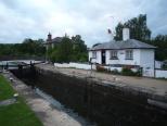
The building just left of centre is Stockers House.
Stockers House below Stocker's Lock No. 82, Grand Union Canal near Rickmansworth, Hertfordshire, England. The house appears on the extreme left in this image. In the foreground is a Coal Tax post listed as No. 218 in this list.
The house was built in 1861-2 by the City of London Corporation for the inspector of coal traffic on the canal. The height is explained because its site is on the downstream side of the lock and there was a need to be able to see boats approaching from the upstream side. Listed Building No. 1173911.
2012-06-07 20:32:03 Fr:126008 Sq:0595011
A collection of old tools on display beside the lock plus an old sign with the stern warning the towing path is private property … there is no public right of way. In fact most canal towpaths are not rights of way but "permissive paths".

Obelisk 60
2012-06-07 20:44:25 Fr:126u02 Sq:060002
maps
2012-06-07 20:47:27 Fr:126010 Sq:060010
2012-06-07 20:48:12 Fr:126011 Sq:060011
Post 65
0000-00-00 00:00:00 Fr:037166 Sq:065_0
2003-07-20 15:37:04 Fr:037167 Sq:065_167
0000-00-00 00:00:00 Fr:037168 Sq:065_168
Post 66
0000-00-00 00:00:00 Fr:037169 Sq:066_169
Post 67
0000-00-00 00:00:00 Fr:037171 Sq:067_171
0000-00-00 00:00:00 Fr:037173 Sq:067_173
0000-00-00 00:00:00 Fr:037174 Sq:067_174
Plate 68
2003-07-20 16:21:28 Fr:037170 Sq:068_170
Obelisk 69
0000-00-00 00:00:00 Fr:037175 Sq:069_175 0000-00-00 00:00:00 Fr:037175 Sq:069_175 0000-00-00 00:00:00 Fr:037175 Sq:069_175
0000-00-00 00:00:00 Fr:037176 Sq:069_176
0000-00-00 00:00:00 Fr:037177 Sq:069_177 0000-00-00 00:00:00 Fr:037177 Sq:069_177 0000-00-00 00:00:00 Fr:037177 Sq:069_177
0000-00-00 00:00:00 Fr:037178 Sq:069_178

Thorney
Post 72
2020-07-03 09:35:44 Fr:grip072 Sq:072.8
Post 73
2020-07-03 09:35:42 Fr:grip073 Sq:073.8

Longford
Posts 74 and 75
0000-00-00 00:00:00 Fr:038028 Sq:074.0
or Post 75
Posts 74 and 75 both probably lost forever during the building of the M25 which can be seen in the background of this image. The Wraysbury (or Wyrardisbury) River may well have been moved by a few yards.
Similarly Post 149 probably disappeared during the building of the M25. Compare with Posts 80 and 81 which appear to have been relocated during the building of the Wraysbury (or Wyrardisbury) Reservoir
0000-00-00 00:00:00 Fr:038029 Sq:074.1 0000-00-00 00:00:00 Fr:038029 Sq:074.1 0000-00-00 00:00:00 Fr:038029 Sq:074.1
Mad Bridge

Poyle
Post 76
The Nail list gives a description of TQ 037 770 on S bank of stream at NE corner of grounds of Poyle County Infants School.
It is probably the same school which is now called Pippins Primary School. A better grid ref for the post is probably TQ 0360 7692 and the post may be visible from Pippins Park accessed off Raymond Close
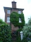
Poyle Pump
0000-00-00 00:00:00 Fr:038022 Sq:076.5.1 0000-00-00 00:00:00 Fr:038022 Sq:076.5.1 0000-00-00 00:00:00 Fr:038022 Sq:076.5.1
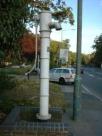
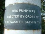
TQ 034 766 Poyle Pump S side of Bath Road about 10 yards E of junction with Dickens Place
2003-08-02 06:16:11 Fr:038020 Sq:076.5.5 2003-08-02 06:16:11 Fr:038020 Sq:076.5.5 2003-08-02 06:16:11 Fr:038020 Sq:076.5.5
2003-08-02 06:16:42 Fr:038021 Sq:076.5.6 2003-08-02 06:16:42 Fr:038021 Sq:076.5.6 2003-08-02 06:16:42 Fr:038021 Sq:076.5.6

Colnbrook
Plate 77
0000-00-00 00:00:00 Fr:038025 Sq:077.0 0000-00-00 00:00:00 Fr:038025 Sq:077.0 0000-00-00 00:00:00 Fr:038025 Sq:077.0
2003-08-02 06:58:07 Fr:038024 Sq:077.7
Opposite side of bridge
Post 78
0000-00-00 00:00:00 Fr:038026 Sq:078.0
0000-00-00 00:00:00 Fr:038027 Sq:078.2 0000-00-00 00:00:00 Fr:038027 Sq:078.2 0000-00-00 00:00:00 Fr:038027 Sq:078.2
with Plate 77 visible at far left
Post 80
2003-08-02 06:28:45 Fr:038023 Sq:080.0
Reservoir sheep

Staines
Post 81?
0000-00-00 00:00:00 Fr:037186 Sq:081_0
Wraysbury Road, Staines
0000-00-00 00:00:00 Fr:037030 Sq:081_030
Obelisk 82
0000-00-00 00:00:00 Fr:037184 Sq:082.184
0000-00-00 00:00:00 Fr:037185 Sq:082.185
0000-00-00 00:00:00 Fr:037187 Sq:082.187
0000-00-00 00:00:00 Fr:037029 Sq:082_029

London Stone
Stone 83
2003-07-04 18:23:08 Fr:037028 Sq:083_00 2003-07-04 18:23:08 Fr:037028 Sq:083_00 2003-07-04 18:23:08 Fr:037028 Sq:083_00
The London Stone - the great … great grandparent of the posts.
2003-07-20 18:39:40 Fr:037183 Sq:083_01
2003-07-04 18:17:31 Fr:037022 Sq:083_022
2003-07-04 18:17:50 Fr:037023 Sq:083_023
2003-07-04 18:18:15 Fr:037024 Sq:083_024
2003-07-04 18:18:52 Fr:037025 Sq:083_025
2003-07-04 18:19:36 Fr:037026 Sq:083_026
0000-00-00 00:00:00 Fr:037027 Sq:083_027 0000-00-00 00:00:00 Fr:037027 Sq:083_027 0000-00-00 00:00:00 Fr:037027 Sq:083_027
Bridge 73
0000-00-00 00:00:00 Fr:038261 Sq:083_71
Downstream digression
2007-01-31 16:25:47 Fr:tq8678_342 Sq:083_73

Navigation

back to start of section
previous  un-annotatednext
previouslike this next
redisplay with: 33 47 93 132 items
full screen     search     index
$_COOKIE['vpt_dims']=×,  $_COOKIE['pathome']=,  $_COOKIE['em2px']=13.1 - more / less space for descriptions

Coal Tax contents  |  Post List
 
php file date:  2023 Jun 23  19:26:00 Valid HTML5 logo! Valid CSS! Valid Links!