Coal Tax contents |
Post List
Coal and Wine Tax posts - All posts gallery - (SQL)
Thumbnails. No border: thumbnail links to a 640 pixel image. Pink border: thumbnail links to bigger image. Blue border: left hand half of thumbnail links to bigger image; right hand half links to image description on the Wikimedia Commons.
Oxhey
Post 49
TQ 131 926, E side of Oxhey Lane, outside No 1 "The Hollies" and immediately NW of Burntoak Farm
Post 50
I am sure I looked for this on 2012 Jun 07 and could not find it.
Post 51
Northwood
Obelisk 52
I cannot now recall where exactly I took this photo but I am pretty sure it is just the opposite side of the path from Obelisk 52. The railway at this point is the Metropolitan Line between Northwood and Moor Park. I cannot see why
London County Council Tramways should need this box - more than an hundred yards from the nearest tram tracks.
Northwood telephone exchange
Rickmansworth
Post 53
Post 54
I walked about 200m either side of
TQ 084 923 and saw nothing
Moor Park
Post 55
The seam in the road surface indicates that this is still a boundary - between Hillingdon on the left and Three Rivers district of Hertfordshire.
TQ 078 923
Post 56
TQ 069 915 at the junction of White Hill and Jackets Lane. Nothing seen
Post 57
Post 58
++++ when the above is properly organised, use this with proper GPS derived co-ords
Stockers Farm Road Pumping Station
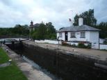
Stockers Lock
Stockers House. Martin Nail lists this as Post 218 but we will show it more in geographical sequence.
The building just left of centre is Stockers House.
A collection of old tools on display beside the lock plus an old sign with the stern warning
the towing path is private property … there is no public right of way. In fact most canal towpaths are not rights of way but "
permissive paths".
Obelisk 60
Post 65
Post 66
Post 67
Plate 68
Obelisk 69
Thorney
Post 72
Post 73
Longford
Posts 74 and 75
or Post 75
Posts 74 and 75 both probably lost forever during the building of the M25 which can be seen in the background of this image. The Wraysbury (or Wyrardisbury) River may well have been moved by a few yards.
Similarly
Post 149 probably disappeared during the building of the M25. Compare with
Posts 80 and 81 which appear to have been relocated during the building of the Wraysbury (or Wyrardisbury) Reservoir
Poyle
Post 76
The Nail list gives a description of
TQ 037 770 on S bank of stream at NE corner of grounds of Poyle County Infants School.
It is probably the same school which is now called Pippins Primary School. A better grid ref for the post is probably
TQ 0360 7692 and the post may be visible from Pippins Park accessed off Raymond Close
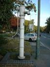
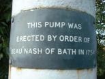
Poyle Pump
TQ 034 766 Poyle Pump
S side of Bath Road about 10 yards E of junction with Dickens Place
Colnbrook
Plate 77
Post 78
with Plate 77 visible at far left
Post 80
Staines
Post 81?
Obelisk 82
London Stone
Stone 83
The London Stone - the great … great grandparent of the posts.
Bridge 73
Downstream digression
Staines
The Old Town Hall
Post 84
Post 85
Post 86
near Post 86
Obelisk 87
Walton on Thames
Post 94
Thames Conservancy post
just upstream of Walton Bridge, near to Post 94
Sunbury on Thames
Post 96
near Post 96
West Molesey
Post 98
Post 99
Post 100
Esher
Obelisk 102
Post 103
Post 104
Post 105
Post 106
Post 107
Post 108
Post 109

109,
TQ 141 622 Copsem Lane, Oxshott
Corner of The Rythe private road, south of Esher Common Roundabout
TQ 1407 6220
Copsem Lane, Oxshott
Corner of The Rythe private road
Oxshott
Post 110

110,
TQ 140 618
Copsem Lane, Oxshott
junction with Sandy Lane and Warren Lane
Obelisk 111
Post 112
Malden Rushett
Post 115
Epsom
Post 116
TQ 173 601, edge of Ashtead Woods 800 yards south of Rushett Farm, Malden Rushett
about 200 yards south west of Post 116
Post 117
TQ 178 606, edge of Ashtead Woods 500 yards south east of Rushett Farm, Malden Rushett
Post 118
Has been repositioned some time in the last nine years
Post 119
In the wood about 100 yards south of Post 119. The water tower of the former West Park Mental Hospital. As in other former hospitals, the tower will probably be retained as part of the redevelopment for housing
Post 120
TQ 181 609, near Woodcock Corner, 250 yards S of Glanmire Farm, Epsom
I am dubious about whether the post numbers hereabout reflect the true sequence
Post 122
Post 123
Post 125
Post 128
Epsom Downs
Post 129
Panorama
Looking from Post 129, we see Posts 132, 130 and 131
Post 130
Post 131
Epsom
Post 132
Post 133
Tadworth
Post 135
Motts Hill Lane, Tadworth
Post 136
Footpath leading to Withybed Corner
Walton on the Hill
Post 137
Post 138
Post 139
Post 140
Walton Heath
Post 141
Post 142
Post 143
Pond midway between Posts 143 & 144
Post 144
Post 145
Post 146
Post 148 can be seen in the distance on the right
Post 147
Post 148
Mogador Road
Post 149
Martin Nail describes this as Margery Grove. Either the roads were renamed at the time the M25 was built or, more likely, Martin Nail got it wrong. Post 149 was possibly right where the motorway now is.
Post 150
Post 151
Post 152
The view from near Post 152
Post 153
Post 154
Kingswood
Post 155
Chipstead
Post 159
Post 160
Post 161
Post 162
Hooley
Post 163
Boundary
On the Brighton Road midway between Posts 163 and 164 marking the boundary between:
Reigate and Banstead / Croydon
Highways Authority / Transport for London - this being a trunk road
Northward digression
TQ 3120 6176. Someone sent me this picture and asked what is it? It is painted on a wall in Foxley Lane, Purley near the junction with Russell Hill Road, ie. at the junction with those two roads and the Purley Way and Pampisford Road.
The text is “DOT N
o. A23 1900 R”. DOT is Department of Transport,
A23 is the road number and 1900 R is the entry in the DOT’s list. But list of what? The answer is: list of walls, bridges and other structures which were the responsibility of the DOT. (I think I have seen similar signs on bridges.) The name
Department of Transport existed between 1976 and 1997. It and its successors are responsible for trunk roads except, as the "HA/TfL" notice in the previous image indicates
Transport for London looks after this wall.
But why? At some stage, probably at the time of the creation of the Purley one-way system, this bit of Foxley Lane was widened necessitating a retaining wall which became the responsibility of the DOT.
Post 164
Obelisk 165 - not found
Post 166 - accident prone
Post 166
This is kept because the rotated version had some retouching to prevent a white area at top right
Coulsdon
Post 167
Between Posts 167 & 168
Post 168
Whyteleafe
Post 169
Obelisk 170
Post 171
Post 172
Post 173
Post 174
Warlingham
Post 175
Chelsham
Post 176
TQ 364 582 Limpsfield Road, Warlingham outside Sainsbury's.
The spots on this picture are, I believe, fog
Post 177
Post 178
Post 179
Post 180
Post 181
New Addington
Post 183
Post 184
Post 185
Bromley
Post 186
Post 187
Post 188
Post 190
Post 191
Post 192
Post 193
Post 199
Post 200
Swanley
Post 201
Post 202
Post 203
Post 204
Post 205
Obelisk 206
$_COOKIE['vpt_dims']=×, $_COOKIE['pathome']=, $_COOKIE['em2px']=14 -
more /
less space for descriptions


