Coal Tax contents  |  Post List
 

Coal and Wine Tax posts  -  All posts gallery  -  (SQL)

Thumbnails. No border: thumbnail links to a 640 pixel image. Pink border: thumbnail links to bigger image. Blue border: left hand half of thumbnail links to bigger image; right hand half links to image description on the Wikimedia Commons.

Introduction
Many of these images were taken at night because I was working as a private hire, aka minicab, driver specialising in the night shift.
++++ List firms worked for with link to vehicle. Minc0304.cal is good starting point

Romford
Post 1
2004-03-24 02:16:58 Fr:043212 Sq:001_0
2004-03-24 02:15:16 Fr:043208 Sq:001_208
2004-03-24 02:15:39 Fr:043209 Sq:001_209
0000-00-00 00:00:00 Fr:043209ed Sq:001_209ed
2004-03-24 02:16:32 Fr:043211 Sq:001_211
2007-07-25 16:40:18 Fr:n001_555 Sq:001_54
++++ re-photograph to show seam in road surface
2007-07-25 16:37:37 Fr:n001_553 Sq:001_553
2007-07-25 16:39:42 Fr:n001_554 Sq:001_554
The last post in this list, Post 217 has not been found but is described as being on the bank of the Thames. This post is about 9 miles from the point opposite Post 217 on the North bank and about 5 miles from the nearest point on the bank. Why the vast gap? Have all the posts disappeared?
Some possibly have disappeared but I think the answer is also that this area was very marshy and there were few roads through it.
Post 2
0000-00-00 00:00:00 Fr:043217 Sq:002.0
2004-03-24 02:29:42 Fr:043216 Sq:002.2
2007-07-25 16:52:34 Fr:n002_556 Sq:002_556
2007-07-25 16:53:50 Fr:n002_557 Sq:002_557
2007-07-25 16:54:51 Fr:n002_558 Sq:002_558
On Barking & Dagenham / Havering boundary. Note seam in road surface.

Chadwell Heath
Post 3
2007-07-25 18:13:04 Fr:n003_576 Sq:003_0
2007-07-25 17:42:44 Fr:n003_568 Sq:003_568
2007-07-25 17:43:11 Fr:n003_569 Sq:003_569
2007-07-25 18:05:37 Fr:n003_572 Sq:003_572
2007-07-25 18:07:06 Fr:n003_573 Sq:003_573
2007-07-25 18:11:14 Fr:n003_574 Sq:003_574
2007-07-25 18:11:53 Fr:n003_575 Sq:003_575
2007-07-25 18:13:27 Fr:n003_577 Sq:003_577
Post 4
2007-07-25 17:09:51 Fr:n004_562 Sq:004.0
2004-03-24 02:39:15 Fr:043221 Sq:004.1
2004-03-24 02:38:32 Fr:043220 Sq:004.2
2007-07-25 17:07:23 Fr:n004_559 Sq:004_559
2007-07-25 17:08:31 Fr:n004_560 Sq:004_560
2007-07-25 17:08:59 Fr:n004_561 Sq:004_561 2007-07-25 17:08:59 Fr:n004_561 Sq:004_561 2007-07-25 17:08:59 Fr:n004_561 Sq:004_561
2007-07-25 17:11:56 Fr:n004_565 Sq:004_565
2007-07-25 17:12:47 Fr:n004_567 Sq:004_567
2007-07-25 17:11:12 Fr:n004_564 Sq:004_a564
2007-07-25 17:10:51 Fr:n004_563 Sq:004_a569
Perambulation of the Forest of Waltham, 8th September 1641 (17th Charles I). Havering Stone One of the Forest Meer or Boundary Stones set up by authority of the Commissioners appointed under the Great Seal. Re-erected by the Essex County Council and the Essex Field Club. 1909.
See this page on the Hainault Forest website
Post 5
2007-07-25 18:38:34 Fr:n005_578 Sq:005_0
2007-08-29 16:37:04 Fr:n005_343 Sq:005_343
2007-08-29 16:37:39 Fr:n005_344 Sq:005_344
2007-07-25 18:44:07 Fr:n005_579 Sq:005_579
2007-07-25 18:44:45 Fr:n005_580 Sq:005_580
2007-07-25 18:45:10 Fr:n005_581 Sq:005_581
2007-07-25 18:46:22 Fr:n005_582 Sq:005_582
2007-07-25 18:57:57 Fr:n005_583 Sq:005_583
++++ bring in write up from wip_nor and link to link

Collier Row
Post 6
2007-07-25 19:15:20 Fr:n006_586 Sq:006_586
Post 6 should be in the hedge just to the left of the sign but I could see no trace of it. Note seam in road surface.
Post 7
0000-00-00 00:00:00 Fr:043224 Sq:007.0
2007-07-25 19:06:46 Fr:n007_584 Sq:007_584
2007-07-25 19:09:41 Fr:n007_585 Sq:007_585
Hog Hill Road. Apparently, lurking in the vegetation near the speed limit sign there is the Collier Row stone, one of the Hainault Forest boundary stones. The write-up says a "lamp post … was digitally removed". I presume by "lamp post" they actually mean the speed limit sign.
Post 8
2007-07-25 19:27:04 Fr:n008_587 Sq:008_587
2007-07-25 19:34:01 Fr:n008_588 Sq:008_588
2007-07-25 19:38:36 Fr:n008_589 Sq:008_589
2007-07-25 19:52:12 Fr:n009_590 Sq:009_590
2007-07-25 19:52:47 Fr:n009_591 Sq:009_591
2007-07-25 19:53:28 Fr:n009_592 Sq:009_592
2007-07-25 20:25:06 Fr:n010_593 Sq:010_593

Epping
Old Orleans
2003-07-13 18:35:53 Fr:037148 Sq:011.a148
2003-07-13 18:36:40 Fr:037149 Sq:011.a149
++++ decide on best place initinerary

Theydon Bois
Post 11
2003-02-23 03:45:11 Fr:032281 Sq:011_281
maps
2003-02-23 03:46:50 Fr:032282 Sq:011_282
maps
TQ 446 984 At the point where Debden Lane, Loughton becomes Loughton Lane, Theydon Bois.
Opposite an house called “The Boundary”.
The retro-reflective sign in this picture says “Theydon Bois”
2003-02-23 03:47:25 Fr:032283 Sq:011_283
maps
2003-02-23 03:49:46 Fr:032284 Sq:011_284
maps

Epping
Post 12
0000-00-00 00:00:00 Fr:037145 Sq:012.0
2003-07-13 18:15:25 Fr:037143 Sq:012.143
2003-07-13 18:16:05 Fr:037144 Sq:012.144
0000-00-00 00:00:00 Fr:037146 Sq:012.146
0000-00-00 00:00:00 Fr:037147 Sq:012.147
Post 13
2003-03-09 00:12:54 Fr:033035 Sq:013_035
TL 437 004 Epping Road, Epping
about 500 metres SW of the Bell Common Tunnel

Essex
Post 14
2007-08-29 18:09:08 Fr:n014_346 Sq:014_346
2007-08-29 18:10:25 Fr:n014_347 Sq:014_347
2007-08-29 18:11:00 Fr:n014_348 Sq:014_348
2007-08-29 18:12:20 Fr:n014_349 Sq:014_349
2007-08-29 18:14:54 Fr:n014_352 Sq:014_352
Post 15
2007-08-29 18:39:29 Fr:n015_364 Sq:015_364
2007-08-29 18:40:46 Fr:n015_365 Sq:015_365
2007-08-29 18:43:50 Fr:n015_366 Sq:015_366
Post 16
2007-08-29 18:53:53 Fr:n016_368 Sq:016.0
2007-08-29 18:53:05 Fr:n016_367 Sq:016_367
2007-08-29 18:56:47 Fr:n016_372 Sq:016_372
Post 17
2007-08-29 19:03:40 Fr:n017_373 Sq:017_373
2007-08-29 19:04:17 Fr:n017_374 Sq:017_374
2007-08-29 19:05:32 Fr:n017_375 Sq:017_375
2007-08-29 19:06:52 Fr:n017_376 Sq:017_376
Post 18
2007-08-29 19:20:59 Fr:n018_384 Sq:018.0
2007-08-29 19:19:58 Fr:n018_383 Sq:018_383
Post 19
2007-08-29 19:17:11 Fr:n019_382 Sq:019_1
2007-08-29 19:14:29 Fr:n019_379 Sq:019_379
2007-08-29 19:15:15 Fr:n019_380 Sq:019_380
0000-00-00 00:00:00 Fr:n019_381 Sq:019_381
2007-08-29 19:12:32 Fr:n019_378 Sq:019_9

Wormley
Obelisk 20
2003-05-01 05:17:22 Fr:035024 Sq:020_000
0000-00-00 00:00:00 Fr:035023 Sq:020_023
2003-05-01 05:20:59 Fr:035025 Sq:020_025
Obelisk 21
0000-00-00 00:00:00 Fr:035027 Sq:021_0 0000-00-00 00:00:00 Fr:035027 Sq:021_0 0000-00-00 00:00:00 Fr:035027 Sq:021_0
0000-00-00 00:00:00 Fr:035026 Sq:021_026
2003-05-01 05:29:20 Fr:035028 Sq:021_028
2007-08-29 19:48:13 Fr:n021_385 Sq:021_385
2007-08-29 19:48:47 Fr:n021_386 Sq:021_386
2007-08-29 19:49:30 Fr:n021_388 Sq:021_388
2007-08-29 19:51:51 Fr:n021_389 Sq:021_389
2007-08-29 19:52:27 Fr:n021_391 Sq:021_391

Brookmans Park site
At the Brookmans Park site:
Posts 23 & 24
Post  25
not a Tax Post  
Posts 26 & 27
Posts 28 - 30
Obelisk  31
Posts 33 - 36
Wormley
Newgate Street
Essendon
Northaw
Potters Bar
Hawkshead
Colney Heath

Broxbourne
Post 22
2007-08-29 19:58:27 Fr:n022_393 Sq:022_393
2007-08-29 19:59:25 Fr:n022_394 Sq:022_394
2007-08-29 20:00:25 Fr:n022_395 Sq:022_395
2007-08-29 20:01:06 Fr:n022_396 Sq:022_396
2007-08-29 20:01:53 Fr:n022_397 Sq:022_397
Post 23
2007-08-29 20:13:09 Fr:n023_401 Sq:023_401
2007-08-29 20:14:20 Fr:n023_402 Sq:023_402
2007-08-29 20:15:28 Fr:n023_403 Sq:023_403

Hertsmere
Post 31
2020-07-01 18:20:28 Fr:p1090286 Sq:031_
Three decent sized images in this this blog post. On the course of Potters Bar Golf Club - closed in 2018.
(A director fringe golf club closing! This forum thread makes one suggestion: “For a long time it was a Jewish-only course . It probably left it too late to try and change.”)
Post 34
The Queen's Head public house (now apparently closed) stands 50 yards to the east of this post on the corner of Coursers Road and High Street, London Colney. The entry at Historic England for the pub says “canted front bay said to have been used for the collection of Coal Tax”.

London Colney
Post 37
2003-05-12 23:16:35 Fr:035129 Sq:037.0
0000-00-00 00:00:00 Fr:035128 Sq:037.128
Post 38
2003-05-12 23:06:48 Fr:035125 Sq:038.0
2003-05-12 23:04:06 Fr:035124 Sq:038.124
TL 175 032 Shenley Lane, London Colney South side of Broad Colney Bridge
2003-05-12 23:07:25 Fr:035126 Sq:038.126
2003-05-12 23:07:39 Fr:035127 Sq:038.127

Shenley
Post 39
2003-05-12 22:46:10 Fr:035120 Sq:039.0
2003-05-12 22:46:49 Fr:035121 Sq:039.121
2003-05-12 22:51:08 Fr:035122 Sq:039.5_122
Harper Lane, Shenley Midway between these two Tax Posts. Just a post to announce that this is No. 100 but nice echoes of Tax Posts.
Cab drivers on night shift wish that all houses showed their numbers as clearly as this.
Post 40
0000-00-00 00:00:00 Fr:035123 Sq:040_123

Radlett
Post 43
2003-05-12 22:06:50 Fr:035118 Sq:043_118
Post 44
2003-05-12 22:21:42 Fr:035119 Sq:044_119

Watford
Post 47
0000-00-00 00:00:00 Fr:043093 Sq:047_093
Posts 47 and 48
0000-00-00 00:00:00 Fr:043094 Sq:047_094
2004-03-04 19:02:14 Fr:043096 Sq:047_096

Grimsdyke
2012-06-07 15:45:59 Fr:126076 Sq:048976
2012-06-07 15:47:33 Fr:126077 Sq:048977
The house where W. S. Gilbert lived and died. (Cannot think of any connection with Coal Tax Posts!)

Oxhey
Post 49
2012-06-07 15:55:16 Fr:126078 Sq:049078
2012-06-07 15:57:25 Fr:126079 Sq:049079
2012-06-07 15:58:55 Fr:126083 Sq:049083
TQ 131 926, E side of Oxhey Lane, outside No 1 "The Hollies" and immediately NW of Burntoak Farm
Post 50
I am sure I looked for this on 2012 Jun 07 and could not find it.
Post 51
2012-06-07 16:52:05 Fr:126084 Sq:051084
2012-06-07 16:52:57 Fr:126085 Sq:051085
TQ 10608 91682

Northwood
Obelisk 52
2012-06-07 17:16:46 Fr:126087 Sq:052.087
TQ 091 920 maps
o/s NW i/s NW   o/s NE i/s NE
i/s SW o/s SW   i/s SE o/s SE
2012-06-07 17:10:52 Fr:126086 Sq:052086
I cannot now recall where exactly I took this photo but I am pretty sure it is just the opposite side of the path from Obelisk 52. The railway at this point is the Metropolitan Line between Northwood and Moor Park. I cannot see why London County Council Tramways should need this box - more than an hundred yards from the nearest tram tracks.

Northwood telephone exchange
2012-06-07 17:50:45 Fr:126t98 Sq:05235
maps

Rickmansworth
Post 53
2012-06-07 17:32:39 Fr:126090 Sq:053090
2012-06-07 17:34:35 Fr:126092 Sq:053092
2012-06-07 17:35:08 Fr:126093 Sq:053093
TQ 087 922
Post 54
2012-06-07 19:22:02 Fr:126097 Sq:054097
I walked about 200m either side of TQ 084 923 and saw nothing
Moor Park
2012-06-07 19:09:42 Fr:126096 Sq:054590
Gates to Moor Park Mansion at TQ 078 925
2012-06-07 19:02:08 Fr:126095 Sq:054592
2012-06-07 19:01:27 Fr:126094 Sq:054594
Moor Park Mansion itself, TQ 074 932
Post 55
2012-06-07 19:33:00 Fr:126004 Sq:055004
2012-06-07 19:34:23 Fr:126005 Sq:055005
The seam in the road surface indicates that this is still a boundary - between Hillingdon on the left and Three Rivers district of Hertfordshire. TQ 078 923
Post 56
2012-06-07 19:50:45 Fr:126006 Sq:056006
TQ 069 915 at the junction of White Hill and Jackets Lane. Nothing seen
Post 57
2012-06-07 19:59:00 Fr:126t99 Sq:057099
maps
Post 58
0000-00-00 00:00:00 Fr:034157 Sq:058.157
2012-06-07 20:04:45 Fr:126u00 Sq:058002
maps
++++ when the above is properly organised, use this with proper GPS derived co-ords
2003-04-14 22:58:50 Fr:034158 Sq:058_158
2003-04-14 22:58:50 Fr:034158cr Sq:058_158cr

Stockers Farm Road Pumping Station
2012-06-07 20:14:41 Fr:126u01 Sq:058_201
maps
Sewage pumping station. See Sewage flows again as Rickmansworth street floods.

Stockers Lock
2012-06-07 20:35:00 Fr:126009 Sq:0595000 2012-06-07 20:35:00 Fr:126009 Sq:0595000 2012-06-07 20:35:00 Fr:126009 Sq:0595000
Stockers House. Martin Nail lists this as Post 218 but we will show it more in geographical sequence.
2012-06-07 20:30:49 Fr:126007 Sq:0595007 2012-06-07 20:30:49 Fr:126007 Sq:0595007 2012-06-07 20:30:49 Fr:126007 Sq:0595007
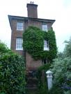
The building just left of centre is Stockers House.
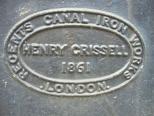
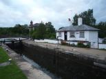
Stockers House below Stocker's Lock No. 82, Grand Union Canal near Rickmansworth, Hertfordshire, England. The house appears on the extreme left in this image. In the foreground is a Coal Tax post listed as No. 218 in this list.
The house was built in 1861-2 by the City of London Corporation for the inspector of coal traffic on the canal. The height is explained because its site is on the downstream side of the lock and there was a need to be able to see boats approaching from the upstream side. Listed Building No. 1173911.
2012-06-07 20:32:03 Fr:126008 Sq:0595011
A collection of old tools on display beside the lock plus an old sign with the stern warning the towing path is private property … there is no public right of way. In fact most canal towpaths are not rights of way but "permissive paths".

Obelisk 60
2012-06-07 20:44:25 Fr:126u02 Sq:060002
maps
2012-06-07 20:47:27 Fr:126010 Sq:060010
2012-06-07 20:48:12 Fr:126011 Sq:060011
Post 65
0000-00-00 00:00:00 Fr:037166 Sq:065_0
2003-07-20 15:37:04 Fr:037167 Sq:065_167
0000-00-00 00:00:00 Fr:037168 Sq:065_168
Post 66
0000-00-00 00:00:00 Fr:037169 Sq:066_169
Post 67
0000-00-00 00:00:00 Fr:037171 Sq:067_171
0000-00-00 00:00:00 Fr:037173 Sq:067_173
0000-00-00 00:00:00 Fr:037174 Sq:067_174
Plate 68
2003-07-20 16:21:28 Fr:037170 Sq:068_170
Obelisk 69
0000-00-00 00:00:00 Fr:037175 Sq:069_175 0000-00-00 00:00:00 Fr:037175 Sq:069_175 0000-00-00 00:00:00 Fr:037175 Sq:069_175
0000-00-00 00:00:00 Fr:037176 Sq:069_176
0000-00-00 00:00:00 Fr:037177 Sq:069_177 0000-00-00 00:00:00 Fr:037177 Sq:069_177 0000-00-00 00:00:00 Fr:037177 Sq:069_177
0000-00-00 00:00:00 Fr:037178 Sq:069_178

Thorney
Post 72
2020-07-03 09:35:44 Fr:grip072 Sq:072.8
Post 73
2020-07-03 09:35:42 Fr:grip073 Sq:073.8

Longford
Posts 74 and 75
0000-00-00 00:00:00 Fr:038028 Sq:074.0
or Post 75
Posts 74 and 75 both probably lost forever during the building of the M25 which can be seen in the background of this image. The Wraysbury (or Wyrardisbury) River may well have been moved by a few yards.
Similarly Post 149 probably disappeared during the building of the M25. Compare with Posts 80 and 81 which appear to have been relocated during the building of the Wraysbury (or Wyrardisbury) Reservoir
0000-00-00 00:00:00 Fr:038029 Sq:074.1 0000-00-00 00:00:00 Fr:038029 Sq:074.1 0000-00-00 00:00:00 Fr:038029 Sq:074.1
Mad Bridge

Poyle
Post 76
The Nail list gives a description of TQ 037 770 on S bank of stream at NE corner of grounds of Poyle County Infants School.
It is probably the same school which is now called Pippins Primary School. A better grid ref for the post is probably TQ 0360 7692 and the post may be visible from Pippins Park accessed off Raymond Close

Poyle Pump
0000-00-00 00:00:00 Fr:038022 Sq:076.5.1 0000-00-00 00:00:00 Fr:038022 Sq:076.5.1 0000-00-00 00:00:00 Fr:038022 Sq:076.5.1
TQ 034 766 Poyle Pump S side of Bath Road about 10 yards E of junction with Dickens Place
2003-08-02 06:16:11 Fr:038020 Sq:076.5.5 2003-08-02 06:16:11 Fr:038020 Sq:076.5.5 2003-08-02 06:16:11 Fr:038020 Sq:076.5.5
2003-08-02 06:16:42 Fr:038021 Sq:076.5.6 2003-08-02 06:16:42 Fr:038021 Sq:076.5.6 2003-08-02 06:16:42 Fr:038021 Sq:076.5.6

Colnbrook
Plate 77
0000-00-00 00:00:00 Fr:038025 Sq:077.0 0000-00-00 00:00:00 Fr:038025 Sq:077.0 0000-00-00 00:00:00 Fr:038025 Sq:077.0
2003-08-02 06:58:07 Fr:038024 Sq:077.7
Opposite side of bridge
Post 78
0000-00-00 00:00:00 Fr:038026 Sq:078.0
0000-00-00 00:00:00 Fr:038027 Sq:078.2 0000-00-00 00:00:00 Fr:038027 Sq:078.2 0000-00-00 00:00:00 Fr:038027 Sq:078.2
with Plate 77 visible at far left
Post 80
2003-08-02 06:28:45 Fr:038023 Sq:080.0
Reservoir sheep

Staines
Post 81?
0000-00-00 00:00:00 Fr:037186 Sq:081_0
Wraysbury Road, Staines
0000-00-00 00:00:00 Fr:037030 Sq:081_030
Obelisk 82
0000-00-00 00:00:00 Fr:037184 Sq:082.184
0000-00-00 00:00:00 Fr:037185 Sq:082.185
0000-00-00 00:00:00 Fr:037187 Sq:082.187
0000-00-00 00:00:00 Fr:037029 Sq:082_029

London Stone
Stone 83
2003-07-04 18:23:08 Fr:037028 Sq:083_00 2003-07-04 18:23:08 Fr:037028 Sq:083_00 2003-07-04 18:23:08 Fr:037028 Sq:083_00
The London Stone - the great … great grandparent of the posts.
2003-07-20 18:39:40 Fr:037183 Sq:083_01
2003-07-04 18:17:31 Fr:037022 Sq:083_022
2003-07-04 18:17:50 Fr:037023 Sq:083_023
2003-07-04 18:18:15 Fr:037024 Sq:083_024
2003-07-04 18:18:52 Fr:037025 Sq:083_025
2003-07-04 18:19:36 Fr:037026 Sq:083_026
0000-00-00 00:00:00 Fr:037027 Sq:083_027 0000-00-00 00:00:00 Fr:037027 Sq:083_027 0000-00-00 00:00:00 Fr:037027 Sq:083_027
Bridge 73
0000-00-00 00:00:00 Fr:038261 Sq:083_71
Downstream digression
2007-01-31 16:25:47 Fr:tq8678_342 Sq:083_73

Staines
The Old Town Hall
2003-07-20 18:21:31 Fr:037179 Sq:083_a179
2003-07-20 18:22:17 Fr:037180 Sq:083_a180
2003-07-20 18:23:06 Fr:037181 Sq:083_a181
2003-07-20 18:24:23 Fr:037182 Sq:083_a182
Post 84
2005-06-21 09:45:07 Fr:056197 Sq:084.197
Post 85
2005-06-21 09:47:44 Fr:056198 Sq:085.198
2005-06-21 09:49:21 Fr:056199 Sq:085.199
2005-06-21 09:58:16 Fr:056200 Sq:085.200
2007-04-30 08:54:35 Fr:074305 Sq:085_305
2007-04-30 08:55:28 Fr:074306 Sq:085_306
2007-04-30 08:57:05 Fr:074307 Sq:085_307
2007-04-30 08:58:28 Fr:074308 Sq:085_308
Post 86
0000-00-00 00:00:00 Fr:074303 Sq:086_0
0000-00-00 00:00:00 Fr:074302 Sq:086_302
2007-04-30 08:53:23 Fr:074304 Sq:086_304
near Post 86
2007-04-30 08:47:30 Fr:074300 Sq:086_b300
2007-04-30 08:48:31 Fr:074301 Sq:086_b301
Obelisk 87
2006-03-14 09:38:02 Fr:063124 Sq:087_124
2006-03-14 09:38:58 Fr:063125 Sq:087_125
2006-03-14 09:40:05 Fr:063127 Sq:087_127

Walton on Thames
Post 94
2003-03-25 07:05:29 Fr:033247 Sq:094_0
0000-00-00 00:00:00 Fr:033245 Sq:094_245
2003-03-25 06:49:59 Fr:033246 Sq:094_246
Thames Conservancy post
2006-03-14 10:26:21 Fr:063133 Sq:094_a133 2006-03-14 10:26:21 Fr:063133 Sq:094_a133 2006-03-14 10:26:21 Fr:063133 Sq:094_a133
just upstream of Walton Bridge, near to Post 94
2006-03-14 10:27:11 Fr:063134 Sq:094_a134
2006-03-14 10:27:38 Fr:063135 Sq:094_a135
2010-07-28 04:27:58 Fr:post 2, front view Sq:094_a2093501
2010-07-28 04:32:02 Fr:post 2, rear view Sq:094_a2093502
2010-07-28 04:30:35 Fr:post 2, detail Sq:094_a2093504
The Wikipedia article about Thames Conservancy shows this post

Sunbury on Thames
Post 96
0000-00-00 00:00:00 Fr:044248 Sq:096.0
2004-04-26 06:45:13 Fr:044245 Sq:096.1
0000-00-00 00:00:00 Fr:044244 Sq:096.244
0000-00-00 00:00:00 Fr:044249 Sq:096.249
0000-00-00 00:00:00 Fr:044250 Sq:096.250
near Post 96
0000-00-00 00:00:00 Fr:044251 Sq:096.b251
2004-04-26 06:53:22 Fr:044252 Sq:096.b252

West Molesey
Post 98
0000-00-00 00:00:00 Fr:037209 Sq:098.209
2003-07-26 07:01:32 Fr:037207 Sq:098_207
2003-07-26 07:02:09 Fr:037208 Sq:098_208
Post 99
0000-00-00 00:00:00 Fr:037210 Sq:099_210
0000-00-00 00:00:00 Fr:037211 Sq:099_211
Post 100
0000-00-00 00:00:00 Fr:037212 Sq:100_212

Esher
Obelisk 102
0000-00-00 00:00:00 Fr:036178 Sq:102_178
Post 103
0000-00-00 00:00:00 Fr:036179 Sq:103_179
Post 104
0000-00-00 00:00:00 Fr:036180 Sq:104_180
Post 105
2005-01-31 09:48:07 Fr:051360 Sq:105_0
0000-00-00 00:00:00 Fr:051358 Sq:105_358
0000-00-00 00:00:00 Fr:051359 Sq:105_359
Post 106
0000-00-00 00:00:00 Fr:051363 Sq:106_0
0000-00-00 00:00:00 Fr:051361 Sq:106_361
Post 107
0000-00-00 00:00:00 Fr:051366 Sq:107_0
0000-00-00 00:00:00 Fr:051365 Sq:107_365
0000-00-00 00:00:00 Fr:051367 Sq:107_367
Post 108
0000-00-00 00:00:00 Fr:051369 Sq:108_
0000-00-00 00:00:00 Fr:051368 Sq:108_368
Post 109
2003-03-23 02:15:30 Fr:033212 Sq:109_212
Marked on map 109, TQ 141 622 Copsem Lane, Oxshott
Corner of The Rythe private road, south of Esher Common Roundabout
2003-03-25 06:48:31 Fr:033244 Sq:109_a244
TQ 1407 6220 Copsem Lane, Oxshott
Corner of The Rythe private road
2003-03-23 02:16:52 Fr:033213 Sq:109_c213

Oxshott
Post 110
2003-03-25 07:13:25 Fr:033250 Sq:110.0
2003-03-25 07:11:11 Fr:033248 Sq:110_248
Copsem Lane
Warren Lane
2003-03-25 07:12:02 Fr:033249 Sq:110_249
Marked on map 110,  TQ 140 618 Copsem Lane, Oxshott
junction with Sandy Lane and Warren Lane
Obelisk 111
2005-02-14 09:40:20 Fr:n111_372 Sq:111_372
Post 112
0000-00-00 00:00:00 Fr:051370 Sq:112_0

Malden Rushett
Post 115
0000-00-00 00:00:00 Fr:036022 Sq:115.0
2012-02-11 17:20:19 Fr:122t07 Sq:115.1
maps
0000-00-00 00:00:00 Fr:036021 Sq:115_021
TQ 16641 59948 Malden Rushett outside "The Star"

Epsom
Post 116
2012-02-11 15:50:44 Fr:122t01 Sq:116155044
maps
2012-02-11 15:50:56 Fr:122120 Sq:116155056
maps
2012-02-11 15:51:28 Fr:122121 Sq:116155128
maps
TQ 173 601, edge of Ashtead Woods 800 yards south of Rushett Farm, Malden Rushett
2012-02-11 15:50:18 Fr:122119 Sq:1161558
maps
2012-02-11 15:45:46 Fr:122118 Sq:1161559
maps
about 200 yards south west of Post 116
Post 117
2012-02-11 16:08:42 Fr:122t02 Sq:117.0
maps
2012-02-11 16:03:31 Fr:122125 Sq:117160331
maps
2012-02-11 16:05:08 Fr:122126 Sq:117160508
maps
2012-02-11 16:05:20 Fr:122127 Sq:117160520
maps
2012-02-11 16:11:59 Fr:122128 Sq:117161159
maps
TQ 178 606, edge of Ashtead Woods 500 yards south east of Rushett Farm, Malden Rushett
2012-02-11 16:52:45 Fr:122t06 Sq:117165245
maps
2012-02-11 16:56:26 Fr:122137 Sq:117165626
maps
2012-02-11 16:57:10 Fr:122139 Sq:117165710
maps
2012-02-11 17:00:20 Fr:122145 Sq:117170020
maps
Post 118
2011-07-30 14:46:50 Fr:118089 Sq:1180
2011-07-30 14:45:44 Fr:118088 Sq:118088
2012-02-11 16:37:14 Fr:122134 Sq:118163714
maps
Has been repositioned some time in the last nine years
2003-03-25 07:34:46 Fr:033257 Sq:118257
2003-07-10 18:53:48 Fr:037040 Sq:11840
2003-03-25 07:23:09 Fr:033251 Sq:1185
My Addison-Lee satnav showing that I am at this location.
Post 119
0000-00-00 00:00:00 Fr:033253 Sq:119.0
0000-00-00 00:00:00 Fr:033254 Sq:119.254
2003-03-25 07:32:13 Fr:033255 Sq:119.255
2003-03-25 07:32:42 Fr:033256 Sq:119.256
0000-00-00 00:00:00 Fr:036023 Sq:119023
0000-00-00 00:00:00 Fr:036024 Sq:119024
2012-02-11 16:30:30 Fr:122t05 Sq:119163030
maps
2012-02-11 16:27:15 Fr:122t04 Sq:11981
maps
2012-02-11 16:27:27 Fr:122133 Sq:11982
maps
In the wood about 100 yards south of Post 119. The water tower of the former West Park Mental Hospital. As in other former hospitals, the tower will probably be retained as part of the redevelopment for housing
Post 120
2012-02-11 16:18:26 Fr:122130 Sq:120161826
maps
2012-02-11 16:19:13 Fr:122131 Sq:120161913
maps
2012-02-11 16:20:04 Fr:122t03 Sq:120162004
maps
TQ 181 609, near Woodcock Corner, 250 yards S of Glanmire Farm, Epsom
I am dubious about whether the post numbers hereabout reflect the true sequence
Post 122
2003-06-07 02:11:27 Fr:036038 Sq:122_038
2003-06-07 02:12:08 Fr:036039 Sq:122_039
Post 123
2006-04-17 03:44:21 Fr:064187 Sq:123_187
2006-04-17 03:45:26 Fr:064189 Sq:123_189
Post 125
2003-04-09 01:16:39 Fr:034011 Sq:125_011
Post 128
2003-06-22 19:37:07 Fr:036202 Sq:128_202

Epsom Downs
Post 129
2003-06-22 19:30:33 Fr:036200 Sq:129.0
2003-06-22 19:31:28 Fr:036201 Sq:129.3
Panorama
0000-00-00 00:00:00 Fr:036177 Sq:129.9
Looking from Post 129, we see Posts 132, 130 and 131
Post 130
0000-00-00 00:00:00 Fr:036176 Sq:130.0
0000-00-00 00:00:00 Fr:036173 Sq:130.3
0000-00-00 00:00:00 Fr:036175 Sq:130.5 0000-00-00 00:00:00 Fr:036175 Sq:130.5 0000-00-00 00:00:00 Fr:036175 Sq:130.5
2003-06-19 17:17:18 Fr:036174 Sq:130.6
Post 131
2003-06-19 17:12:35 Fr:036172 Sq:131.0
2003-06-19 17:11:50 Fr:036171 Sq:131.5

Epsom
Post 132
2003-04-09 02:00:08 Fr:034013 Sq:132_013
Post 133
2003-04-09 02:04:48 Fr:034014 Sq:133_014

Tadworth
Post 135
0000-00-00 00:00:00 Fr:041165 Sq:135.165
0000-00-00 00:00:00 Fr:041166 Sq:135.166
Motts Hill Lane, Tadworth
Post 136
2003-08-08 18:47:48 Fr:038042 Sq:136.0
0000-00-00 00:00:00 Fr:038041 Sq:136.2
Footpath leading to Withybed Corner

Walton on the Hill
Post 137
2003-07-08 19:33:59 Fr:037032 Sq:137_032
0000-00-00 00:00:00 Fr:037033 Sq:137_033
0000-00-00 00:00:00 Fr:037034 Sq:137_034
Post 138
0000-00-00 00:00:00 Fr:039112 Sq:138.0
0000-00-00 00:00:00 Fr:039111 Sq:138.111
2003-07-08 19:44:17 Fr:037035 Sq:138.35
Post 139
0000-00-00 00:00:00 Fr:041163 Sq:139.0
0000-00-00 00:00:00 Fr:041164 Sq:139.ccc
0000-00-00 00:00:00 Fr:041162 Sq:139.lll
Post 140
0000-00-00 00:00:00 Fr:037036 Sq:140_036
0000-00-00 00:00:00 Fr:037037 Sq:140_037
0000-00-00 00:00:00 Fr:037039 Sq:140_039
0000-00-00 00:00:00 Fr:037039dx Sq:140_039dx
2008-08-13 20:13:12 Fr:n140_203 Sq:140_063
2008-08-13 20:14:13 Fr:n140_206 Sq:140_066
2008-08-13 20:01:43 Fr:n140_199 Sq:140_199
2008-08-13 20:11:28 Fr:n140_200 Sq:140_200
2008-08-13 20:12:30 Fr:n140_201 Sq:140_201
2008-08-13 20:12:49 Fr:n140_202 Sq:140_202
2016-03-14 18:36:51 Fr:n140_204 Sq:140_202.5

Walton Heath
Post 141
2008-08-13 20:18:02 Fr:n141_209 Sq:141_209
Post 142
2012-06-04 18:20:36 Fr:126t81 Sq:142182036
maps
2008-08-13 20:22:38 Fr:n142_210 Sq:142_210
2008-08-13 20:23:19 Fr:n142_211 Sq:142_211
2008-08-13 20:24:09 Fr:n142_212 Sq:142_212
Post 143
2012-06-04 18:27:12 Fr:126t82 Sq:143182712
maps
2012-06-04 18:29:16 Fr:126072 Sq:143182916
2012-06-04 21:18:39 Fr:126t96 Sq:143211839
maps
2012-06-04 18:33:53 Fr:126t83 Sq:143283353
maps
Pond midway between Posts 143 & 144
Post 144
2012-06-04 18:39:41 Fr:126t84 Sq:144183941
maps
2012-06-04 18:43:37 Fr:126t85 Sq:144184337
maps
2012-06-04 18:45:20 Fr:126073 Sq:144184520
2012-06-04 21:09:27 Fr:126t95 Sq:144210927
maps
Post 145
2012-06-04 18:46:51 Fr:126t86 Sq:145184651
maps
2012-06-04 18:48:45 Fr:126074 Sq:145184845
2012-06-04 18:49:01 Fr:126t87 Sq:145184901
maps
2012-06-04 18:49:23 Fr:126t88 Sq:145184923
maps
2012-06-04 18:52:06 Fr:126075 Sq:145185206
2012-06-04 21:04:26 Fr:126t93 Sq:145210426
maps
2012-06-04 21:06:08 Fr:126t94 Sq:145310608
maps
Post 146
2012-06-04 18:59:16 Fr:126t89 Sq:146185916
maps
Post 148 can be seen in the distance on the right
2007-09-05 18:19:11 Fr:n146_441 Sq:146_441
2007-09-05 18:19:23 Fr:n146_442 Sq:146_442
2007-09-05 18:21:03 Fr:n146_443 Sq:146_443
2007-09-05 18:22:52 Fr:n146_446 Sq:146_446
Post 147
2012-06-04 19:01:07 Fr:126t90 Sq:147190107
maps
2012-06-04 19:03:20 Fr:126t91 Sq:147190320
maps
2007-09-05 18:30:30 Fr:n147_450 Sq:147_450
2007-09-05 18:32:34 Fr:n147_452 Sq:147_452
Post 148
2007-09-05 18:34:00 Fr:n148_454 Sq:148_454
2007-09-05 18:35:14 Fr:n148_455 Sq:148_455

Mogador Road
Post 149
2012-06-04 19:11:27 Fr:126t92 Sq:149191127
maps
Martin Nail describes this as Margery Grove. Either the roads were renamed at the time the M25 was built or, more likely, Martin Nail got it wrong. Post 149 was possibly right where the motorway now is.
2007-09-05 17:00:00 Fr:n149_428 Sq:149_428
Post 150
2007-09-05 16:54:07 Fr:n150_427 Sq:150.0
2012-06-04 21:44:00 Fr:126t97 Sq:150.2
maps
Post 151
2007-09-05 16:48:00 Fr:n151_424 Sq:151_0
2007-09-05 16:46:55 Fr:n151_423 Sq:151_423
2007-09-05 16:48:55 Fr:n151_425 Sq:151_425
2007-09-05 16:49:49 Fr:n151_426 Sq:151_426
2007-09-05 18:03:46 Fr:n151_440 Sq:151_440
Post 152
2007-09-05 17:58:44 Fr:n152_435 Sq:1520
2007-09-05 17:57:22 Fr:n152_434 Sq:152434
The view from near Post 152
2007-09-05 17:13:37 Fr:tq2452_429 Sq:152a429
2007-09-05 17:14:02 Fr:tq2452_430 Sq:152a430
2007-09-05 17:28:58 Fr:tq2452_431 Sq:152a431
2007-09-05 17:29:34 Fr:tq2452_432 Sq:152a432
2007-09-05 17:56:04 Fr:tq2452_433 Sq:152a433 2007-09-05 17:56:04 Fr:tq2452_433 Sq:152a433 2007-09-05 17:56:04 Fr:tq2452_433 Sq:152a433
Post 153
2004-09-11 06:12:27 Fr:049139 Sq:153.0
2007-09-05 16:29:43 Fr:n153_421 Sq:153_421
2007-09-05 16:31:27 Fr:n153_422 Sq:153_422
2007-09-05 16:28:22 Fr:n153_419 Sq:153_427
Post 154
2003-08-03 21:50:39 Fr:038033 Sq:154.0
Hogden Bottom (I think)

Kingswood
Post 155
0000-00-00 00:00:00 Fr:036156 Sq:155.0
0000-00-00 00:00:00 Fr:036157 Sq:155.2

Chipstead
Post 159
2003-05-28 15:40:17 Fr:035209 Sq:159_0
2003-05-28 15:41:57 Fr:035211 Sq:159_211
Post 160
2003-06-06 19:28:33 Fr:036035 Sq:160_035
2003-06-06 19:29:41 Fr:036036 Sq:160_036
2003-06-06 19:30:33 Fr:036037 Sq:160_037
Post 161
2003-06-09 20:38:45 Fr:036042 Sq:161_042
2020-03-24 13:08:09 Fr:203s89 Sq:161_S89
maps
Post 162
0000-00-00 00:00:00 Fr:035139 Sq:162_0
0000-00-00 00:00:00 Fr:036029 Sq:162_029
Jigsaw of Nail 162
Try this image as a jigsaw
2003-05-19 17:43:57 Fr:035140 Sq:162_140
2003-05-19 17:45:51 Fr:035141 Sq:162_141
0000-00-00 00:00:00 Fr:043234 Sq:162_234

Hooley
Post 163
2003-03-30 17:01:21 Fr:033271 Sq:163.0
0000-00-00 00:00:00 Fr:037015 Sq:163_015
2020-06-24 17:50:56 Fr:206124 Sq:163_124
maps
2020-06-24 17:56:35 Fr:206125 Sq:163_125
maps
2020-06-24 17:58:06 Fr:206130 Sq:163_130
maps
2003-03-30 16:56:57 Fr:033267 Sq:163_267
2003-03-30 16:57:51 Fr:033268 Sq:163_268
2003-03-30 16:59:49 Fr:033269 Sq:163_269
0000-00-00 00:00:00 Fr:033270 Sq:163_270
Boundary
0000-00-00 00:00:00 Fr:035033 Sq:163_b1
2003-05-05 17:06:21 Fr:035034 Sq:163_b2
On the Brighton Road midway between Posts 163 and 164 marking the boundary between:
Reigate and Banstead / Croydon
Highways Authority / Transport for London - this being a trunk road
Northward digression
2020-07-14 16:40:43 Fr:207s94 Sq:163_c01
maps
TQ 3120 6176. Someone sent me this picture and asked what is it? It is painted on a wall in Foxley Lane, Purley near the junction with Russell Hill Road, ie. at the junction with those two roads and the Purley Way and Pampisford Road.
The text is “DOT No. A23 1900 R”. DOT is Department of Transport, A23 is the road number and 1900 R is the entry in the DOT’s list. But list of what? The answer is: list of walls, bridges and other structures which were the responsibility of the DOT. (I think I have seen similar signs on bridges.) The name Department of Transport existed between 1976 and 1997. It and its successors are responsible for trunk roads except, as the "HA/TfL" notice in the previous image indicates Transport for London looks after this wall.
But why? At some stage, probably at the time of the creation of the Purley one-way system, this bit of Foxley Lane was widened necessitating a retaining wall which became the responsibility of the DOT.
Post 164
2003-05-18 05:32:29 Fr:035136 Sq:164_136
0000-00-00 00:00:00 Fr:035137 Sq:164_137
2003-05-18 05:34:49 Fr:035138 Sq:164_138

Obelisk 165 - not found
2003-07-02 17:52:21 Fr:037011 Sq:165_011
2003-07-02 17:53:18 Fr:037012 Sq:165_012
2003-07-02 17:54:59 Fr:037013 Sq:165_013
2003-07-02 17:55:50 Fr:037014 Sq:165_014
2003-07-03 17:30:33 Fr:037016 Sq:165_016
2003-07-03 17:31:05 Fr:037017 Sq:165_017
2003-07-03 17:32:19 Fr:037018 Sq:165_018
2003-07-03 17:33:09 Fr:037019 Sq:165_019

Post 166 - accident prone
2006-04-06 03:16:32 Fr:0e512a20 Sq:166-0e512a20
2006-04-06 03:17:49 Fr:g022931x Sq:166-g022931x
2003-03-18 07:26:58 Fr:033172 Sq:166.0
Ditches Lane / Devilsden Wood. See its eventful life.
2006-04-02 07:30:29 Fr:n166_050 Sq:166_050
2006-04-02 07:31:01 Fr:n166_051 Sq:166_051
2006-04-02 07:31:01 Fr:n166_051xt Sq:166_051xt
2006-04-02 07:31:52 Fr:n166_052 Sq:166_052
2006-04-02 07:32:18 Fr:n166_053 Sq:166_053
2006-04-06 03:18:12 Fr:l201198 Sq:166_1201198
2020-06-24 17:15:22 Fr:206122 Sq:166_122
maps
2020-06-24 17:15:49 Fr:206123 Sq:166_123
maps
2003-03-18 07:27:20 Fr:033173 Sq:166_173
2007-09-09 15:15:44 Fr:033174 Sq:166_174
0000-00-00 00:00:00 Fr:033175 Sq:166_175
Post 166
2003-12-21 20:59:50 Fr:03c221 Sq:166_221
0000-00-00 00:00:00 Fr:n166_322 Sq:166_322
0000-00-00 00:00:00 Fr:n166_323 Sq:166_323
0000-00-00 00:00:00 Fr:n166_324 Sq:166_324
0000-00-00 00:00:00 Fr:n166_325 Sq:166_325
2009-05-18 06:27:41 Fr:n166_325cr Sq:166_325cr
0000-00-00 00:00:00 Fr:n166_326 Sq:166_326
0000-00-00 00:00:00 Fr:033174dx Sq:166_z
This is kept because the rotated version had some retouching to prevent a white area at top right

Coulsdon
Post 167
2003-05-10 17:51:03 Fr:035110 Sq:167.0
2003-05-10 17:51:56 Fr:035111 Sq:167_111
0000-00-00 00:00:00 Fr:035109 Sq:167_2
Between Posts 167 & 168
2003-05-10 17:54:08 Fr:035112 Sq:167_b112
0000-00-00 00:00:00 Fr:035113 Sq:167_b113
0000-00-00 00:00:00 Fr:035113xt Sq:167_b113xt
2003-05-07 20:01:11 Fr:035042 Sq:167_b5
Post 168
2003-05-23 16:46:13 Fr:035207 Sq:168.0
2003-05-23 16:46:58 Fr:035208 Sq:168.2
0000-00-00 00:00:00 Fr:036203 Sq:168_203
0000-00-00 00:00:00 Fr:036204 Sq:168_204
2004-03-31 18:50:10 Fr:043335 Sq:168_335
0000-00-00 00:00:00 Fr:037031 Sq:168_b031

Whyteleafe
Post 169
2003-05-31 02:24:17 Fr:035213 Sq:169_0
2006-06-04 05:53:36 Fr:n169_073 Sq:169_073
2004-06-28 05:57:10 Fr:n169_207 Sq:169_207
2003-05-31 02:23:41 Fr:035212 Sq:169_212
Obelisk 170
2006-06-04 06:06:55 Fr:n170_078 Sq:170.0
2006-06-04 06:06:29 Fr:n170_077 Sq:170.2
0000-00-00 00:00:00 Fr:036034 Sq:170_034
2006-06-04 06:04:36 Fr:n170_074 Sq:170_074
0000-00-00 00:00:00 Fr:n170_932 Sq:170_932
0000-00-00 00:00:00 Fr:n170_933 Sq:170_933
2006-06-04 06:05:34 Fr:n170_076 Sq:170_a
Post 171
0000-00-00 00:00:00 Fr:036043 Sq:171_043
0000-00-00 00:00:00 Fr:036044 Sq:171_044
2003-06-10 06:58:02 Fr:036045 Sq:171_045
Post 172
0000-00-00 00:00:00 Fr:036046 Sq:172_046
Post 173
0000-00-00 00:00:00 Fr:036048 Sq:173_048
Post 174
2003-03-07 01:20:56 Fr:033023 Sq:174_023
0000-00-00 00:00:00 Fr:033024 Sq:174_024
2003-05-07 12:29:54 Fr:035037 Sq:174_037
2003-05-07 12:30:45 Fr:035038 Sq:174_038
2003-05-07 12:31:38 Fr:035039 Sq:174_039
0000-00-00 00:00:00 Fr:03503fsm Sq:174_03fsm
2003-05-07 12:34:07 Fr:035040 Sq:174_040

Warlingham
Post 175
2003-06-05 01:20:20 Fr:036025 Sq:175_025
2003-06-05 01:20:56 Fr:036026 Sq:175_026
0000-00-00 00:00:00 Fr:036049 Sq:175_049

Chelsham
Post 176
0000-00-00 00:00:00 Fr:033025 Sq:176.0
TQ 364 582 Limpsfield Road, Warlingham outside Sainsbury's.
The spots on this picture are, I believe, fog
0000-00-00 00:00:00 Fr:051256 Sq:176.05
0000-00-00 00:00:00 Fr:051257 Sq:176.3
2004-05-01 07:02:28 Fr:045029 Sq:176.4
2004-05-01 06:59:43 Fr:045027 Sq:176_027
2004-05-01 07:05:53 Fr:045030 Sq:176_030
0000-00-00 00:00:00 Fr:045031 Sq:176_031
Post 177
2003-03-07 01:38:48 Fr:033026 Sq:177_026
2003-03-07 01:40:30 Fr:033027 Sq:177_027
TQ 36587 58364 Sunny Bank, Warlingham junction of Chelsham Road
Post 178
2003-02-19 15:44:15 Fr:032168 Sq:178_168
Post 179
0000-00-00 00:00:00 Fr:036027 Sq:179_027
Post 180
2003-06-10 08:04:57 Fr:036050 Sq:180_050
Post 181
0000-00-00 00:00:00 Fr:05c146 Sq:181.0
2005-12-13 14:33:03 Fr:05c147 Sq:181.147 2005-12-13 14:33:03 Fr:05c147 Sq:181.147 2005-12-13 14:33:03 Fr:05c147 Sq:181.147
2005-12-13 14:35:30 Fr:05c149 Sq:181.149

New Addington
Post 183
0000-00-00 00:00:00 Fr:047221 Sq:183.0
2003-08-08 21:24:23 Fr:038044 Sq:183.1
0000-00-00 00:00:00 Fr:047214 Sq:183.214
0000-00-00 00:00:00 Fr:047216 Sq:183.216
Post 184
2003-04-30 13:58:00 Fr:035002 Sq:184_002
0000-00-00 00:00:00 Fr:035003 Sq:184_003
Post 185
0000-00-00 00:00:00 Fr:035004 Sq:185_004
2003-04-30 14:06:30 Fr:035005 Sq:185_005

Bromley
Post 186
2003-04-30 14:17:00 Fr:035006 Sq:186_006 2003-04-30 14:17:00 Fr:035006 Sq:186_006 2003-04-30 14:17:00 Fr:035006 Sq:186_006
2003-04-30 14:17:21 Fr:035007 Sq:186_007
2003-04-30 14:18:00 Fr:035008 Sq:186_008 2003-04-30 14:18:00 Fr:035008 Sq:186_008 2003-04-30 14:18:00 Fr:035008 Sq:186_008
0000-00-00 00:00:00 Fr:wkgolf Sq:187-wkgolf
Post 187
2003-04-30 14:28:54 Fr:035009 Sq:187_009
Post 188
0000-00-00 00:00:00 Fr:035010 Sq:188_010
0000-00-00 00:00:00 Fr:035011 Sq:188_011
0000-00-00 00:00:00 Fr:035012 Sq:188_012
Post 190
0000-00-00 00:00:00 Fr:038043 Sq:190.0
Post 191
0000-00-00 00:00:00 Fr:035013 Sq:191_013
0000-00-00 00:00:00 Fr:grnstg Sq:191_grnstg
Image has been flopped
Post 192
2003-04-30 15:11:16 Fr:035018 Sq:192.0
2003-04-30 15:08:48 Fr:035015 Sq:192_015
2003-04-30 15:11:40 Fr:035019 Sq:192_019
2010-06-22 13:46:51 Fr:n192_248 Sq:192_248
Post 193
2003-08-07 04:55:41 Fr:038035 Sq:193.0
Post 199
2003-05-31 21:07:07 Fr:n199_219 Sq:199_219
Post 200
2006-04-12 16:43:10 Fr:tq4865_159 Sq:200_310 2006-04-12 16:43:10 Fr:tq4865_159 Sq:200_310 2006-04-12 16:43:10 Fr:tq4865_159 Sq:200_310

Swanley
Post 201
2006-04-12 17:06:48 Fr:tq5065_167 Sq:201.0 2006-04-12 17:06:48 Fr:tq5065_167 Sq:201.0 2006-04-12 17:06:48 Fr:tq5065_167 Sq:201.0
2006-04-12 17:04:15 Fr:tq5065_164 Sq:201_164
2006-04-12 17:05:11 Fr:tq5065_165 Sq:201_165
Post 202
2006-04-12 18:54:33 Fr:tq4967_186 Sq:202_186
TQ 49864 67091
Post 203
2006-04-12 17:49:39 Fr:tq5067_172 Sq:203_172
2006-04-12 17:51:13 Fr:tq5067_173 Sq:203_173
Post 204
2006-04-12 17:40:43 Fr:tq5067_170 Sq:204_170
2006-04-12 17:41:33 Fr:tq5067_171 Sq:204_171
Post 205
2006-04-12 18:00:17 Fr:tq5067_174 Sq:205_174
not found
Obelisk 206
2006-04-12 18:34:31 Fr:tq5068_181 Sq:206_0
2006-04-12 18:18:31 Fr:tq5068_178 Sq:206_178
2006-04-12 18:20:23 Fr:tq5068_179 Sq:206_179
2006-04-12 18:35:03 Fr:tq5068_182 Sq:206_182

Bexley
Post 207
2006-08-02 17:03:31 Fr:tq5069_622 Sq:207_622
2006-08-02 17:04:38 Fr:tq5069_623 Sq:207_623
n207_623
Post 208
2006-08-02 17:16:32 Fr:tq5072_626 Sq:208_626
2006-08-02 17:18:21 Fr:tq5072_628 Sq:208_628
2006-08-02 17:21:39 Fr:tq5072_632 Sq:208_632
Post 209
2006-08-02 17:30:40 Fr:tq5072_634 Sq:209_0
2006-08-02 17:29:07 Fr:tq5072_633 Sq:209_633
Nail No. 209 Jigsaw Puzzle
Jigsaw puzzle
n209_633
2006-08-02 17:31:59 Fr:tq5072_635 Sq:209_635
South side of Dartford Road/Old Bexley Lane on the present Bexley/Dartford boundary. Satellite images show the road surface changing about 5 yards to the right of the post’s present position. This is a good indication of the exact boundary. I think this post has been moved about 5 yards to the left so that it did not obstruct the Chinese take-away. Another strong indication is that its inscription plate is facing the hedge!
Post 210
2010-09-25 18:01:46 Fr:tq5173_384 Sq:210.0146
2010-09-25 18:02:33 Fr:tq5173_385 Sq:210.0233
2010-09-25 18:03:28 Fr:tq5173_386 Sq:210.0328
TQ 51197 73966 on the north corner of the junction of Melrose Avenue and Falstaff Close. The quarry mentioned by Martin Nail has been redeveloped as housing. No idea how far this post is from its original position. The people re-siting this post had a very strange idea: instead of sinking it into the ground, they stood it on the pavement and then encased its legs in concrete.

Kent
Post 211
2010-09-25 17:53:35 Fr:tq5173_381 Sq:211.5335
TQ 51641 73865. The Hillcrest Road sign is misleading. The road in the foreground is Station Road. This post may have been moved slightly since Galloway Drive (the road sign at far right) is new since Martin Nail's list was prepared.
Post 212
2010-09-25 17:38:39 Fr:tq5274_379 Sq:212.3839
2010-09-25 17:40:03 Fr:tq5274_380 Sq:212.4003
Post 213
2010-09-25 17:35:12 Fr:tq5274_378 Sq:213.3512
Post 214
2010-09-25 17:28:10 Fr:tq5274_373 Sq:214.2810
Post 215?
2010-09-25 17:31:10 Fr:tq5274_376 Sq:215.3110
Obelisk 215 may be somewhere behind the fence but the vegetation is too dense

Crayford Ness
2010-09-25 16:37:26 Fr:tq5378_370 Sq:2170
2010-09-25 16:09:55 Fr:tq5377_358 Sq:2170955
2010-09-25 16:15:51 Fr:tq5377_359 Sq:2171551
2010-09-25 16:16:17 Fr:tq5377_361 Sq:2171617
2010-09-25 16:21:40 Fr:tq5377_363 Sq:2172140
2010-09-25 16:26:08 Fr:tq5377_364 Sq:2172608
2010-09-25 16:26:43 Fr:tq5377_365cr Sq:2172643
2010-09-25 16:26:43 Fr:tq5377_365 Sq:2172644
2010-09-25 16:28:48 Fr:tq5378_366 Sq:2172848
Obelisk 217 should be around here but I could not see anything
2010-09-25 16:29:14 Fr:tq5378_367 Sq:2172914
2010-09-25 16:30:27 Fr:tq5378_368 Sq:2173027
2010-09-25 16:32:35 Fr:tq5378_369 Sq:2173235
2010-09-25 16:40:46 Fr:tq5378_371 Sq:2174046
2010-09-25 16:43:27 Fr:tq5378_372 Sq:2174327

Other
0000-00-00 00:00:00 Fr:nopicyet Sq:znopicyet
No picture yet placeholder
0000-00-00 00:00:00 Fr:036160s Sq:zrwh
Roger W. Haworth - creator of this website

Navigation

un-annotated
like this
redisplay with: 144 203 288 407 575 items
full screen     search     index
$_COOKIE['vpt_dims']=×,  $_COOKIE['pathome']=,  $_COOKIE['em2px']=14.1 - more / less space for descriptions

Coal Tax contents  |  Post List
 
php file date:  2023 Jun 23  20:26:00 Valid HTML5 logo! Valid CSS! Valid Links!